You are here: Home > Network List > US - United States National Seismic Network Stations List
> Station WRAK Wrangell Island, Southeastern Alaska, Alaska, USA > Earthquake Result Viewer
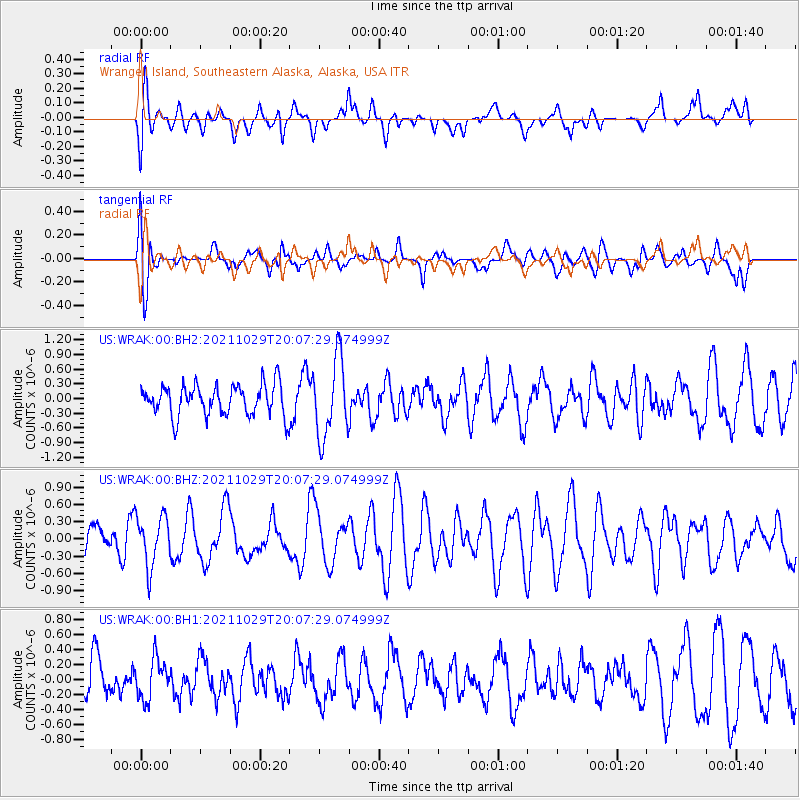
WRAK Wrangell Island, Southeastern Alaska, Alaska, USA - Earthquake Result Viewer
*The percent match for this event was below the threshold and hence no stack was calculated.
| Earthquake location: |
Near Coast Of Peru |
| Earthquake latitude/longitude: |
-15.1/-74.0 |
| Earthquake time(UTC): |
2021/10/29 (302) 19:55:26 GMT |
| Earthquake Depth: |
73 km |
| Earthquake Magnitude: |
5.2 Mww |
| Earthquake Catalog/Contributor: |
NEIC PDE/us |
|
| Network: |
US United States National Seismic Network |
| Station: |
WRAK Wrangell Island, Southeastern Alaska, Alaska, USA |
| Lat/Lon: |
56.42 N/132.35 W |
| Elevation: |
81 m |
|
| Distance: |
86.2 deg |
| Az: |
331.702 deg |
| Baz: |
124.505 deg |
| Ray Param: |
$rayparam |
*The percent match for this event was below the threshold and hence was not used in the summary stack. |
|
| Radial Match: |
53.842785 % |
| Radial Bump: |
400 |
| Transverse Match: |
63.519024 % |
| Transverse Bump: |
400 |
| SOD ConfigId: |
26497111 |
| Insert Time: |
2021-11-12 20:13:13.186 +0000 |
| GWidth: |
2.5 |
| Max Bumps: |
400 |
| Tol: |
0.001 |
|
Signal To Noise
| Channel | StoN | STA | LTA |
| US:WRAK:00:BHZ:20211029T20:07:29.074999Z | 0.7658291 | 4.3266346E-7 | 5.649609E-7 |
| US:WRAK:00:BH1:20211029T20:07:29.074999Z | 0.7063817 | 2.712051E-7 | 3.8393563E-7 |
| US:WRAK:00:BH2:20211029T20:07:29.074999Z | 2.5607696 | 8.0463167E-7 | 3.142148E-7 |
| Arrivals |
| Ps | |
| PpPs | |
| PsPs/PpSs | |


