You are here: Home > Network List > GS - US Geological Survey Networks Stations List
> Station OK051 E0350 and S34600 roads, Ralston OK > Earthquake Result Viewer
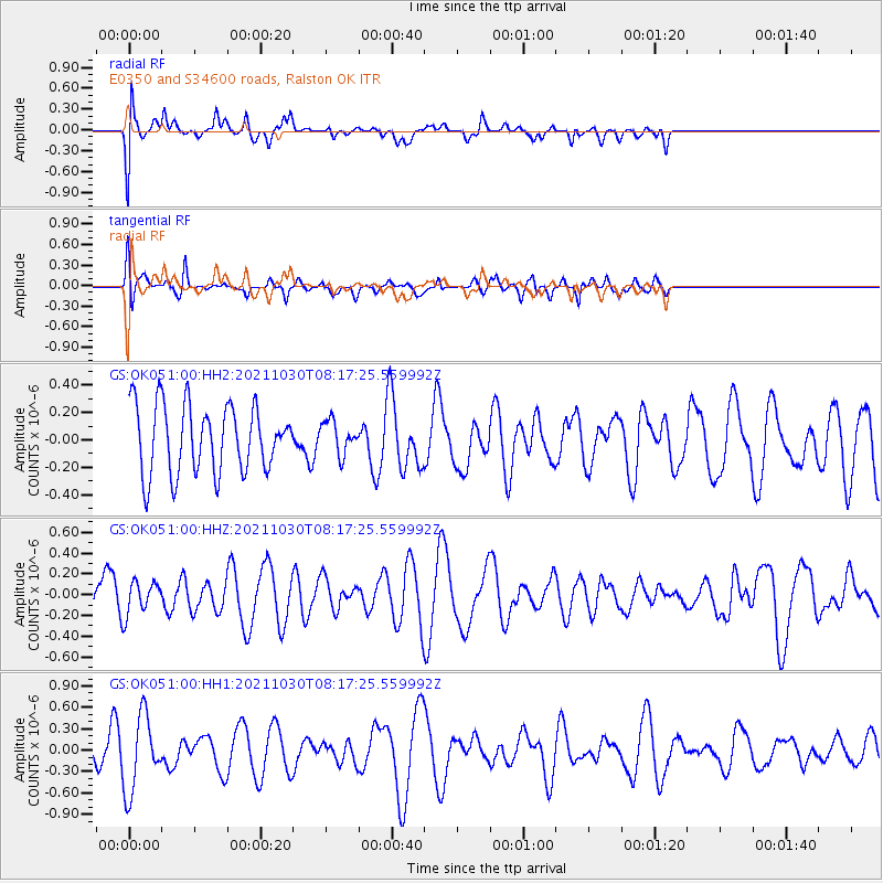
OK051 E0350 and S34600 roads, Ralston OK - Earthquake Result Viewer
*The percent match for this event was below the threshold and hence no stack was calculated.
| Earthquake location: |
Fiji Islands Region |
| Earthquake latitude/longitude: |
-19.6/-177.6 |
| Earthquake time(UTC): |
2021/10/30 (303) 08:05:19 GMT |
| Earthquake Depth: |
379 km |
| Earthquake Magnitude: |
5.5 mww |
| Earthquake Catalog/Contributor: |
NEIC PDE/us |
|
| Network: |
GS US Geological Survey Networks |
| Station: |
OK051 E0350 and S34600 roads, Ralston OK |
| Lat/Lon: |
36.50 N/96.84 W |
| Elevation: |
263 m |
|
| Distance: |
94.4 deg |
| Az: |
52.91 deg |
| Baz: |
248.947 deg |
| Ray Param: |
$rayparam |
*The percent match for this event was below the threshold and hence was not used in the summary stack. |
|
| Radial Match: |
45.4385 % |
| Radial Bump: |
400 |
| Transverse Match: |
53.906467 % |
| Transverse Bump: |
400 |
| SOD ConfigId: |
26497111 |
| Insert Time: |
2021-11-13 08:14:53.283 +0000 |
| GWidth: |
2.5 |
| Max Bumps: |
400 |
| Tol: |
0.001 |
|
Signal To Noise
| Channel | StoN | STA | LTA |
| GS:OK051:00:HHZ:20211030T08:17:25.559992Z | 0.76294184 | 1.5984494E-7 | 2.0951133E-7 |
| GS:OK051:00:HH1:20211030T08:17:25.559992Z | 2.252557 | 5.29537E-7 | 2.3508261E-7 |
| GS:OK051:00:HH2:20211030T08:17:25.559992Z | 0.488415 | 1.2068905E-7 | 2.471035E-7 |
| Arrivals |
| Ps | |
| PpPs | |
| PsPs/PpSs | |


