You are here: Home > Network List > IU - Global Seismograph Network (GSN - IRIS/USGS) Stations List
> Station RSSD Black Hills, South Dakota, USA > Earthquake Result Viewer
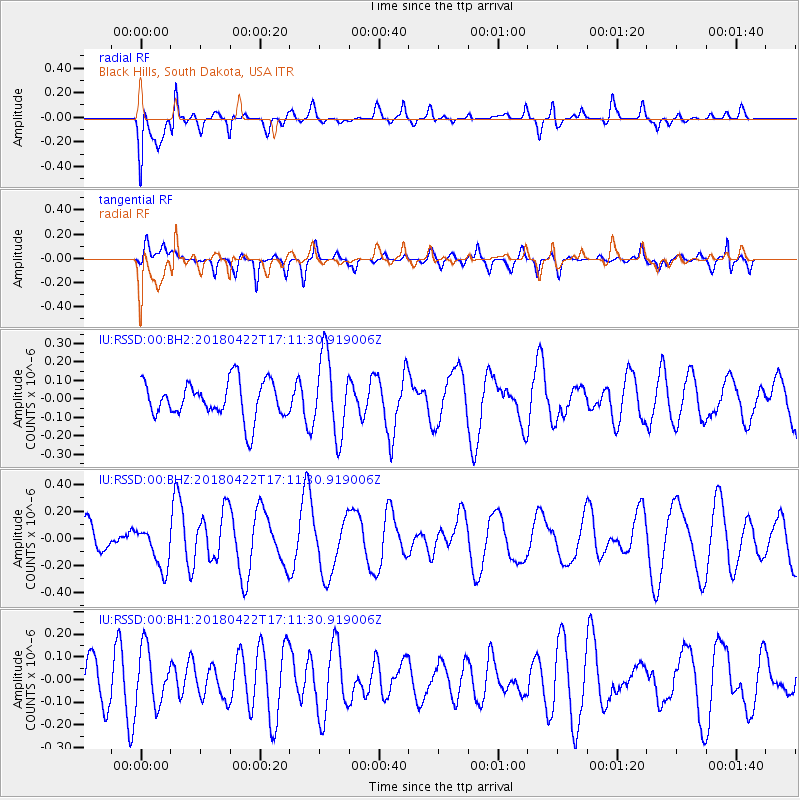
RSSD Black Hills, South Dakota, USA - Earthquake Result Viewer
*The percent match for this event was below the threshold and hence no stack was calculated.
| Earthquake location: |
Tonga Islands |
| Earthquake latitude/longitude: |
-15.5/-174.5 |
| Earthquake time(UTC): |
2018/04/22 (112) 16:59:16 GMT |
| Earthquake Depth: |
10 km |
| Earthquake Magnitude: |
5.6 Mww |
| Earthquake Catalog/Contributor: |
NEIC PDE/us |
|
| Network: |
IU Global Seismograph Network (GSN - IRIS/USGS) |
| Station: |
RSSD Black Hills, South Dakota, USA |
| Lat/Lon: |
44.12 N/104.04 W |
| Elevation: |
2090 m |
|
| Distance: |
87.2 deg |
| Az: |
42.803 deg |
| Baz: |
245.468 deg |
| Ray Param: |
$rayparam |
*The percent match for this event was below the threshold and hence was not used in the summary stack. |
|
| Radial Match: |
71.5139 % |
| Radial Bump: |
400 |
| Transverse Match: |
48.3942 % |
| Transverse Bump: |
400 |
| SOD ConfigId: |
2665671 |
| Insert Time: |
2018-05-06 17:01:52.903 +0000 |
| GWidth: |
2.5 |
| Max Bumps: |
400 |
| Tol: |
0.001 |
|
Signal To Noise
| Channel | StoN | STA | LTA |
| IU:RSSD:00:BHZ:20180422T17:11:30.919006Z | 1.0873041 | 1.5601647E-7 | 1.4348927E-7 |
| IU:RSSD:00:BH1:20180422T17:11:30.919006Z | 0.7732563 | 1.2257888E-7 | 1.5852297E-7 |
| IU:RSSD:00:BH2:20180422T17:11:30.919006Z | 2.1547394 | 2.141678E-7 | 9.939383E-8 |
| Arrivals |
| Ps | |
| PpPs | |
| PsPs/PpSs | |


