You are here: Home > Network List > CI - Caltech Regional Seismic Network Stations List
> Station BFS Mt Baldy Forest Station > Earthquake Result Viewer
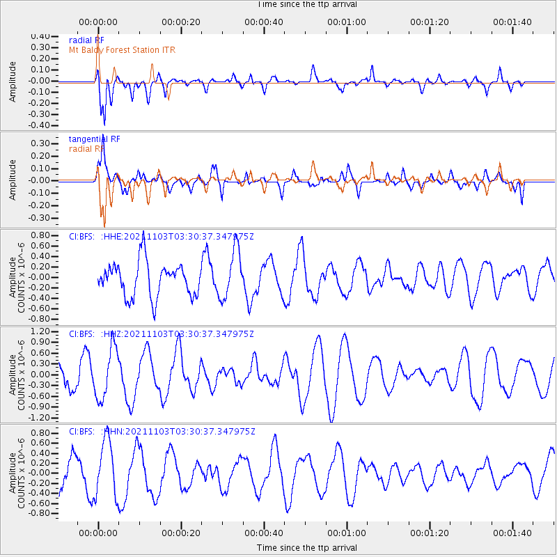
BFS Mt Baldy Forest Station - Earthquake Result Viewer
*The percent match for this event was below the threshold and hence no stack was calculated.
| Earthquake location: |
South Of Tonga Islands |
| Earthquake latitude/longitude: |
-24.5/-175.9 |
| Earthquake time(UTC): |
2021/11/03 (307) 03:19:00 GMT |
| Earthquake Depth: |
35 km |
| Earthquake Magnitude: |
5.7 mww |
| Earthquake Catalog/Contributor: |
NEIC PDE/us |
|
| Network: |
CI Caltech Regional Seismic Network |
| Station: |
BFS Mt Baldy Forest Station |
| Lat/Lon: |
34.24 N/117.66 W |
| Elevation: |
1312 m |
|
| Distance: |
80.4 deg |
| Az: |
45.598 deg |
| Baz: |
231.791 deg |
| Ray Param: |
$rayparam |
*The percent match for this event was below the threshold and hence was not used in the summary stack. |
|
| Radial Match: |
61.31898 % |
| Radial Bump: |
400 |
| Transverse Match: |
64.8247 % |
| Transverse Bump: |
400 |
| SOD ConfigId: |
26694651 |
| Insert Time: |
2021-11-17 03:40:27.121 +0000 |
| GWidth: |
2.5 |
| Max Bumps: |
400 |
| Tol: |
0.001 |
|
Signal To Noise
| Channel | StoN | STA | LTA |
| CI:BFS: :HHZ:20211103T03:30:37.347975Z | 2.5881166 | 7.17237E-7 | 2.77127E-7 |
| CI:BFS: :HHN:20211103T03:30:37.347975Z | 2.4044483 | 5.716889E-7 | 2.37763E-7 |
| CI:BFS: :HHE:20211103T03:30:37.347975Z | 1.4555588 | 4.7285712E-7 | 3.2486295E-7 |
| Arrivals |
| Ps | |
| PpPs | |
| PsPs/PpSs | |


