You are here: Home > Network List > CI - Caltech Regional Seismic Network Stations List
> Station MPP McPhearson Peak > Earthquake Result Viewer
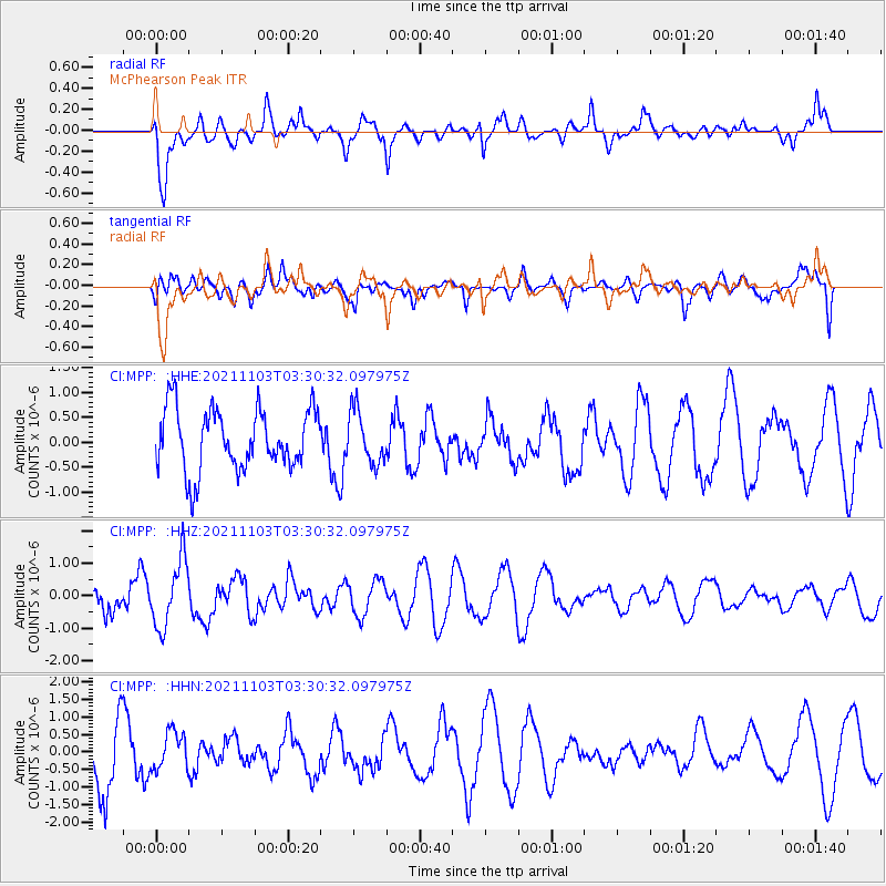
MPP McPhearson Peak - Earthquake Result Viewer
*The percent match for this event was below the threshold and hence no stack was calculated.
| Earthquake location: |
South Of Tonga Islands |
| Earthquake latitude/longitude: |
-24.5/-175.9 |
| Earthquake time(UTC): |
2021/11/03 (307) 03:19:00 GMT |
| Earthquake Depth: |
35 km |
| Earthquake Magnitude: |
5.7 mww |
| Earthquake Catalog/Contributor: |
NEIC PDE/us |
|
| Network: |
CI Caltech Regional Seismic Network |
| Station: |
MPP McPhearson Peak |
| Lat/Lon: |
34.89 N/119.81 W |
| Elevation: |
1739 m |
|
| Distance: |
79.4 deg |
| Az: |
43.95 deg |
| Baz: |
230.286 deg |
| Ray Param: |
$rayparam |
*The percent match for this event was below the threshold and hence was not used in the summary stack. |
|
| Radial Match: |
72.461235 % |
| Radial Bump: |
400 |
| Transverse Match: |
70.399414 % |
| Transverse Bump: |
400 |
| SOD ConfigId: |
26694651 |
| Insert Time: |
2021-11-17 03:40:55.780 +0000 |
| GWidth: |
2.5 |
| Max Bumps: |
400 |
| Tol: |
0.001 |
|
Signal To Noise
| Channel | StoN | STA | LTA |
| CI:MPP: :HHZ:20211103T03:30:32.097975Z | 2.3454282 | 1.0327718E-6 | 4.4033402E-7 |
| CI:MPP: :HHN:20211103T03:30:32.097975Z | 0.70841247 | 5.28195E-7 | 7.456038E-7 |
| CI:MPP: :HHE:20211103T03:30:32.097975Z | 0.8602084 | 5.266586E-7 | 6.122454E-7 |
| Arrivals |
| Ps | |
| PpPs | |
| PsPs/PpSs | |


