You are here: Home > Network List > US - United States National Seismic Network Stations List
> Station OGNE Ogallala, Nebraska, USA > Earthquake Result Viewer
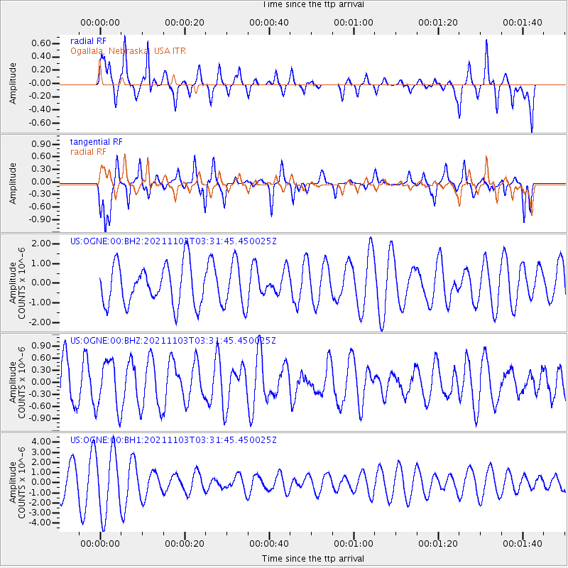
OGNE Ogallala, Nebraska, USA - Earthquake Result Viewer
*The percent match for this event was below the threshold and hence no stack was calculated.
| Earthquake location: |
South Of Tonga Islands |
| Earthquake latitude/longitude: |
-24.5/-175.9 |
| Earthquake time(UTC): |
2021/11/03 (307) 03:19:00 GMT |
| Earthquake Depth: |
35 km |
| Earthquake Magnitude: |
5.7 mww |
| Earthquake Catalog/Contributor: |
NEIC PDE/us |
|
| Network: |
US United States National Seismic Network |
| Station: |
OGNE Ogallala, Nebraska, USA |
| Lat/Lon: |
40.95 N/102.03 W |
| Elevation: |
1054 m |
|
| Distance: |
94.4 deg |
| Az: |
46.879 deg |
| Baz: |
241.394 deg |
| Ray Param: |
$rayparam |
*The percent match for this event was below the threshold and hence was not used in the summary stack. |
|
| Radial Match: |
58.69093 % |
| Radial Bump: |
263 |
| Transverse Match: |
52.956326 % |
| Transverse Bump: |
287 |
| SOD ConfigId: |
26694651 |
| Insert Time: |
2021-11-17 03:49:05.078 +0000 |
| GWidth: |
2.5 |
| Max Bumps: |
400 |
| Tol: |
0.001 |
|
Signal To Noise
| Channel | StoN | STA | LTA |
| US:OGNE:00:BHZ:20211103T03:31:45.450025Z | 1.2482332 | 6.020824E-7 | 4.823477E-7 |
| US:OGNE:00:BH1:20211103T03:31:45.450025Z | 2.152872 | 3.0432475E-6 | 1.4135755E-6 |
| US:OGNE:00:BH2:20211103T03:31:45.450025Z | 1.1496372 | 1.1702691E-6 | 1.0179465E-6 |
| Arrivals |
| Ps | |
| PpPs | |
| PsPs/PpSs | |


