You are here: Home > Network List > UW - Pacific Northwest Regional Seismic Network Stations List
> Station UMAT Pilot Rock, OR, USA > Earthquake Result Viewer
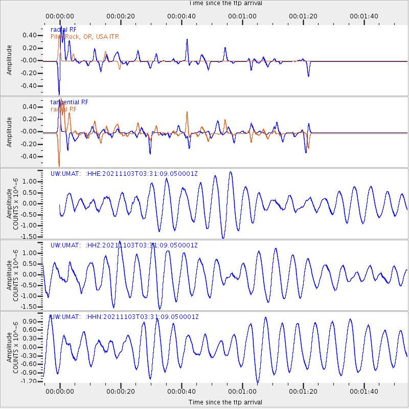
UMAT Pilot Rock, OR, USA - Earthquake Result Viewer
*The percent match for this event was below the threshold and hence no stack was calculated.
| Earthquake location: |
South Of Tonga Islands |
| Earthquake latitude/longitude: |
-24.5/-175.9 |
| Earthquake time(UTC): |
2021/11/03 (307) 03:19:00 GMT |
| Earthquake Depth: |
35 km |
| Earthquake Magnitude: |
5.7 mww |
| Earthquake Catalog/Contributor: |
NEIC PDE/us |
|
| Network: |
UW Pacific Northwest Regional Seismic Network |
| Station: |
UMAT Pilot Rock, OR, USA |
| Lat/Lon: |
45.29 N/118.96 W |
| Elevation: |
1318 m |
|
| Distance: |
86.6 deg |
| Az: |
36.35 deg |
| Baz: |
229.911 deg |
| Ray Param: |
$rayparam |
*The percent match for this event was below the threshold and hence was not used in the summary stack. |
|
| Radial Match: |
73.850296 % |
| Radial Bump: |
400 |
| Transverse Match: |
49.18043 % |
| Transverse Bump: |
337 |
| SOD ConfigId: |
26694651 |
| Insert Time: |
2021-11-17 03:50:16.089 +0000 |
| GWidth: |
2.5 |
| Max Bumps: |
400 |
| Tol: |
0.001 |
|
Signal To Noise
| Channel | StoN | STA | LTA |
| UW:UMAT: :HHZ:20211103T03:31:09.050001Z | 0.5734482 | 2.8486537E-7 | 4.967587E-7 |
| UW:UMAT: :HHN:20211103T03:31:09.050001Z | 0.7407416 | 4.1752557E-7 | 5.6365883E-7 |
| UW:UMAT: :HHE:20211103T03:31:09.050001Z | 2.5391436 | 7.358064E-7 | 2.8978525E-7 |
| Arrivals |
| Ps | |
| PpPs | |
| PsPs/PpSs | |


