You are here: Home > Network List > US - United States National Seismic Network Stations List
> Station AMTX Amarillo, Texas, USA > Earthquake Result Viewer
AMTX Amarillo, Texas, USA - Earthquake Result Viewer
*The percent match for this event was below the threshold and hence no stack was calculated.
| Earthquake location: |
Colombia |
| Earthquake latitude/longitude: |
5.2/-75.5 |
| Earthquake time(UTC): |
2018/04/23 (113) 15:42:10 GMT |
| Earthquake Depth: |
113 km |
| Earthquake Magnitude: |
5.2 Mww |
| Earthquake Catalog/Contributor: |
NEIC PDE/us |
|
| Network: |
US United States National Seismic Network |
| Station: |
AMTX Amarillo, Texas, USA |
| Lat/Lon: |
34.53 N/101.41 W |
| Elevation: |
1010 m |
|
| Distance: |
37.8 deg |
| Az: |
323.975 deg |
| Baz: |
134.806 deg |
| Ray Param: |
$rayparam |
*The percent match for this event was below the threshold and hence was not used in the summary stack. |
|
| Radial Match: |
65.41721 % |
| Radial Bump: |
400 |
| Transverse Match: |
68.76398 % |
| Transverse Bump: |
400 |
| SOD ConfigId: |
2665671 |
| Insert Time: |
2018-05-07 15:51:47.770 +0000 |
| GWidth: |
2.5 |
| Max Bumps: |
400 |
| Tol: |
0.001 |
|
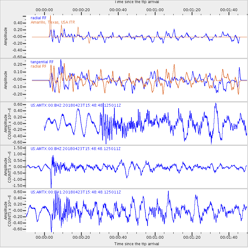
Signal To Noise
| Channel | StoN | STA | LTA |
| US:AMTX:00:BHZ:20180423T15:48:48.125011Z | 2.9320471 | 4.683897E-7 | 1.5974835E-7 |
| US:AMTX:00:BH1:20180423T15:48:48.125011Z | 2.189623 | 2.1739855E-7 | 9.9285835E-8 |
| US:AMTX:00:BH2:20180423T15:48:48.125011Z | 1.0106081 | 1.9621079E-7 | 1.9415121E-7 |
| Arrivals |
| Ps | |
| PpPs | |
| PsPs/PpSs | |


