You are here: Home > Network List > US - United States National Seismic Network Stations List
> Station WUAZ Wupatki, Arizona, USA > Earthquake Result Viewer
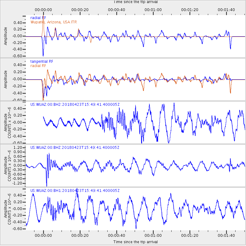
WUAZ Wupatki, Arizona, USA - Earthquake Result Viewer
*The percent match for this event was below the threshold and hence no stack was calculated.
| Earthquake location: |
Colombia |
| Earthquake latitude/longitude: |
5.2/-75.5 |
| Earthquake time(UTC): |
2018/04/23 (113) 15:42:10 GMT |
| Earthquake Depth: |
113 km |
| Earthquake Magnitude: |
5.2 Mww |
| Earthquake Catalog/Contributor: |
NEIC PDE/us |
|
| Network: |
US United States National Seismic Network |
| Station: |
WUAZ Wupatki, Arizona, USA |
| Lat/Lon: |
35.52 N/111.37 W |
| Elevation: |
1592 m |
|
| Distance: |
44.7 deg |
| Az: |
317.252 deg |
| Baz: |
124.035 deg |
| Ray Param: |
$rayparam |
*The percent match for this event was below the threshold and hence was not used in the summary stack. |
|
| Radial Match: |
69.12037 % |
| Radial Bump: |
400 |
| Transverse Match: |
67.738266 % |
| Transverse Bump: |
400 |
| SOD ConfigId: |
2665671 |
| Insert Time: |
2018-05-07 15:52:39.478 +0000 |
| GWidth: |
2.5 |
| Max Bumps: |
400 |
| Tol: |
0.001 |
|
Signal To Noise
| Channel | StoN | STA | LTA |
| US:WUAZ:00:BHZ:20180423T15:49:41.400005Z | 4.056479 | 4.3231614E-7 | 1.06574234E-7 |
| US:WUAZ:00:BH1:20180423T15:49:41.400005Z | 0.62797827 | 1.5062365E-7 | 2.3985487E-7 |
| US:WUAZ:00:BH2:20180423T15:49:41.400005Z | 1.2724961 | 1.0542416E-7 | 8.284832E-8 |
| Arrivals |
| Ps | |
| PpPs | |
| PsPs/PpSs | |


