You are here: Home > Network List > US - United States National Seismic Network Stations List
> Station EGMT Eagleton, Montana, USA > Earthquake Result Viewer
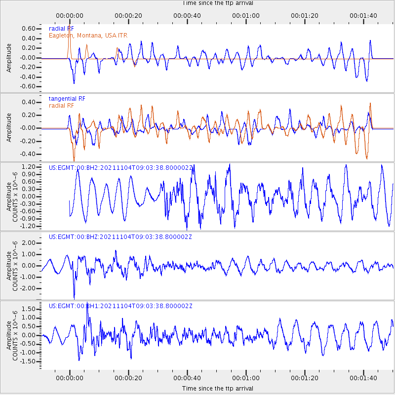
EGMT Eagleton, Montana, USA - Earthquake Result Viewer
*The percent match for this event was below the threshold and hence no stack was calculated.
| Earthquake location: |
Fox Islands, Aleutian Islands |
| Earthquake latitude/longitude: |
52.7/-168.0 |
| Earthquake time(UTC): |
2021/11/04 (308) 08:57:06 GMT |
| Earthquake Depth: |
36 km |
| Earthquake Magnitude: |
5.2 Mww |
| Earthquake Catalog/Contributor: |
NEIC PDE/us |
|
| Network: |
US United States National Seismic Network |
| Station: |
EGMT Eagleton, Montana, USA |
| Lat/Lon: |
48.02 N/109.75 W |
| Elevation: |
1055 m |
|
| Distance: |
36.6 deg |
| Az: |
73.36 deg |
| Baz: |
299.706 deg |
| Ray Param: |
$rayparam |
*The percent match for this event was below the threshold and hence was not used in the summary stack. |
|
| Radial Match: |
62.975864 % |
| Radial Bump: |
400 |
| Transverse Match: |
67.6403 % |
| Transverse Bump: |
400 |
| SOD ConfigId: |
26694651 |
| Insert Time: |
2021-11-18 09:14:36.695 +0000 |
| GWidth: |
2.5 |
| Max Bumps: |
400 |
| Tol: |
0.001 |
|
Signal To Noise
| Channel | StoN | STA | LTA |
| US:EGMT:00:BHZ:20211104T09:03:38.800002Z | 3.3113167 | 9.638858E-7 | 2.9108836E-7 |
| US:EGMT:00:BH1:20211104T09:03:38.800002Z | 1.8447031 | 6.173864E-7 | 3.3468064E-7 |
| US:EGMT:00:BH2:20211104T09:03:38.800002Z | 0.7067863 | 3.9145917E-7 | 5.538579E-7 |
| Arrivals |
| Ps | |
| PpPs | |
| PsPs/PpSs | |


