You are here: Home > Network List > AV - Alaska Volcano Observatory Stations List
> Station MAPS Pakushin Southeast, Makushin Volcano, Alaska > Earthquake Result Viewer
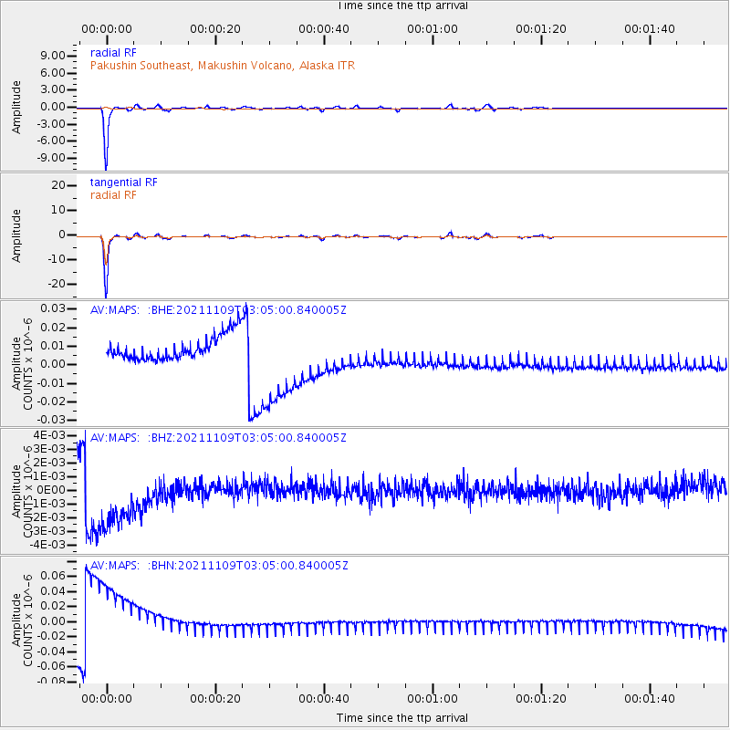
MAPS Pakushin Southeast, Makushin Volcano, Alaska - Earthquake Result Viewer
*The percent match for this event was below the threshold and hence no stack was calculated.
| Earthquake location: |
Near Coast Of Nicaragua |
| Earthquake latitude/longitude: |
11.2/-86.7 |
| Earthquake time(UTC): |
2021/11/09 (313) 02:53:49 GMT |
| Earthquake Depth: |
17 km |
| Earthquake Magnitude: |
5.9 mww |
| Earthquake Catalog/Contributor: |
NEIC PDE/us |
|
| Network: |
AV Alaska Volcano Observatory |
| Station: |
MAPS Pakushin Southeast, Makushin Volcano, Alaska |
| Lat/Lon: |
53.81 N/166.94 W |
| Elevation: |
333 m |
|
| Distance: |
75.3 deg |
| Az: |
322.826 deg |
| Baz: |
91.168 deg |
| Ray Param: |
$rayparam |
*The percent match for this event was below the threshold and hence was not used in the summary stack. |
|
| Radial Match: |
97.1709 % |
| Radial Bump: |
157 |
| Transverse Match: |
97.14925 % |
| Transverse Bump: |
157 |
| SOD ConfigId: |
26694651 |
| Insert Time: |
2021-11-23 02:59:55.038 +0000 |
| GWidth: |
2.5 |
| Max Bumps: |
400 |
| Tol: |
0.001 |
|
Signal To Noise
| Channel | StoN | STA | LTA |
| AV:MAPS: :BHZ:20211109T03:05:00.840005Z | 3.4610665 | 3.1843195E-9 | 9.2003993E-10 |
| AV:MAPS: :BHN:20211109T03:05:00.840005Z | 4.077136 | 6.018264E-8 | 1.47610075E-8 |
| AV:MAPS: :BHE:20211109T03:05:00.840005Z | 4.1014566 | 2.6035094E-8 | 6.3477676E-9 |
| Arrivals |
| Ps | |
| PpPs | |
| PsPs/PpSs | |


