You are here: Home > Network List > CI - Caltech Regional Seismic Network Stations List
> Station MPM Manuel Prospect Mine, California, USA > Earthquake Result Viewer
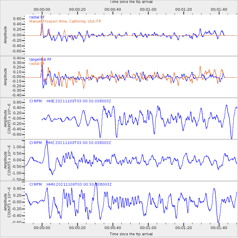
MPM Manuel Prospect Mine, California, USA - Earthquake Result Viewer
*The percent match for this event was below the threshold and hence no stack was calculated.
| Earthquake location: |
Near Coast Of Nicaragua |
| Earthquake latitude/longitude: |
11.2/-86.7 |
| Earthquake time(UTC): |
2021/11/09 (313) 02:53:49 GMT |
| Earthquake Depth: |
17 km |
| Earthquake Magnitude: |
5.9 mww |
| Earthquake Catalog/Contributor: |
NEIC PDE/us |
|
| Network: |
CI Caltech Regional Seismic Network |
| Station: |
MPM Manuel Prospect Mine, California, USA |
| Lat/Lon: |
36.06 N/117.49 W |
| Elevation: |
185 m |
|
| Distance: |
37.3 deg |
| Az: |
316.76 deg |
| Baz: |
123.936 deg |
| Ray Param: |
$rayparam |
*The percent match for this event was below the threshold and hence was not used in the summary stack. |
|
| Radial Match: |
66.09642 % |
| Radial Bump: |
400 |
| Transverse Match: |
54.446297 % |
| Transverse Bump: |
400 |
| SOD ConfigId: |
26694651 |
| Insert Time: |
2021-11-23 03:04:46.598 +0000 |
| GWidth: |
2.5 |
| Max Bumps: |
400 |
| Tol: |
0.001 |
|
Signal To Noise
| Channel | StoN | STA | LTA |
| CI:MPM: :HHZ:20211109T03:00:30.038003Z | 3.0231974 | 7.2424245E-7 | 2.3956176E-7 |
| CI:MPM: :HHN:20211109T03:00:30.038003Z | 1.2210286 | 2.4667955E-7 | 2.0202603E-7 |
| CI:MPM: :HHE:20211109T03:00:30.038003Z | 2.8934584 | 3.1701305E-7 | 1.0956199E-7 |
| Arrivals |
| Ps | |
| PpPs | |
| PsPs/PpSs | |


