You are here: Home > Network List > CN - Canadian National Seismograph Network Stations List
> Station INK INUVIK, NT > Earthquake Result Viewer
INK INUVIK, NT - Earthquake Result Viewer
*The percent match for this event was below the threshold and hence no stack was calculated.
| Earthquake location: |
Near Coast Of Nicaragua |
| Earthquake latitude/longitude: |
11.2/-86.7 |
| Earthquake time(UTC): |
2021/11/09 (313) 02:53:49 GMT |
| Earthquake Depth: |
17 km |
| Earthquake Magnitude: |
5.9 mww |
| Earthquake Catalog/Contributor: |
NEIC PDE/us |
|
| Network: |
CN Canadian National Seismograph Network |
| Station: |
INK INUVIK, NT |
| Lat/Lon: |
68.31 N/133.53 W |
| Elevation: |
44 m |
|
| Distance: |
64.7 deg |
| Az: |
342.538 deg |
| Baz: |
127.623 deg |
| Ray Param: |
$rayparam |
*The percent match for this event was below the threshold and hence was not used in the summary stack. |
|
| Radial Match: |
63.469074 % |
| Radial Bump: |
313 |
| Transverse Match: |
48.860363 % |
| Transverse Bump: |
325 |
| SOD ConfigId: |
26694651 |
| Insert Time: |
2021-11-23 03:06:19.277 +0000 |
| GWidth: |
2.5 |
| Max Bumps: |
400 |
| Tol: |
0.001 |
|
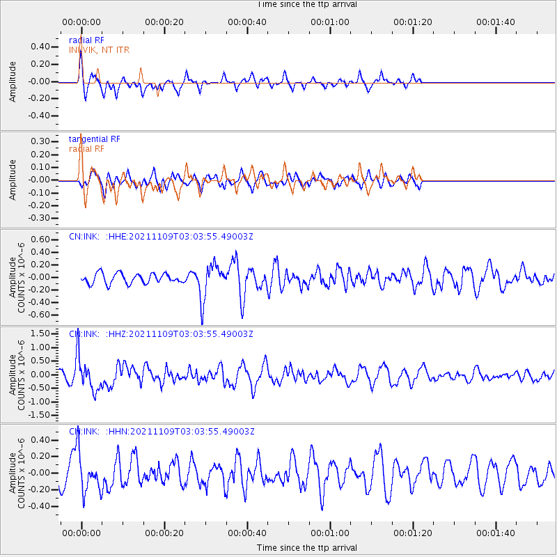
Signal To Noise
| Channel | StoN | STA | LTA |
| CN:INK: :HHZ:20211109T03:03:55.49003Z | 4.2546864 | 6.316087E-7 | 1.4845013E-7 |
| CN:INK: :HHN:20211109T03:03:55.49003Z | 2.1332457 | 2.3055138E-7 | 1.08075405E-7 |
| CN:INK: :HHE:20211109T03:03:55.49003Z | 3.544255 | 2.8028433E-7 | 7.90813E-8 |
| Arrivals |
| Ps | |
| PpPs | |
| PsPs/PpSs | |


