You are here: Home > Network List > UW - Pacific Northwest Regional Seismic Network Stations List
> Station HOOD Mt Hood Meadows, OR CREST BB SMO > Earthquake Result Viewer
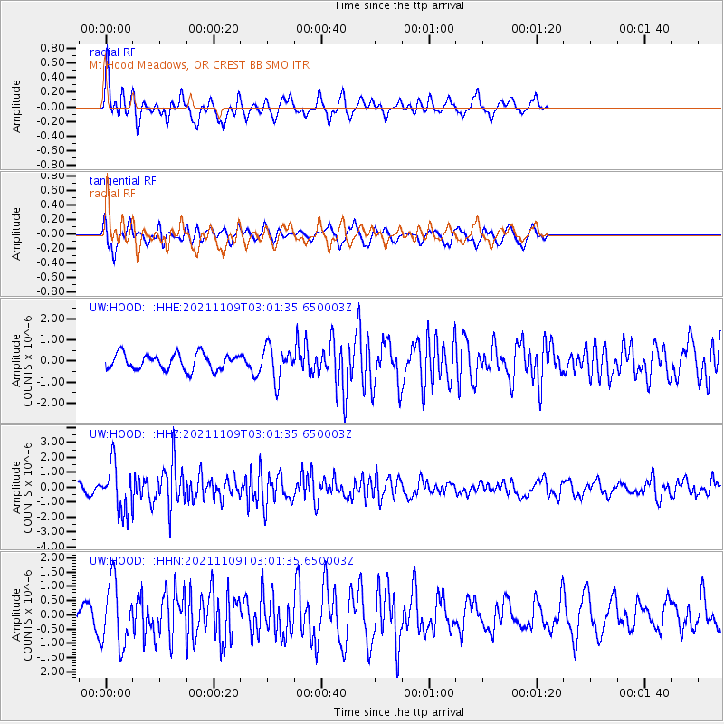
HOOD Mt Hood Meadows, OR CREST BB SMO - Earthquake Result Viewer
*The percent match for this event was below the threshold and hence no stack was calculated.
| Earthquake location: |
Near Coast Of Nicaragua |
| Earthquake latitude/longitude: |
11.2/-86.7 |
| Earthquake time(UTC): |
2021/11/09 (313) 02:53:49 GMT |
| Earthquake Depth: |
17 km |
| Earthquake Magnitude: |
5.9 mww |
| Earthquake Catalog/Contributor: |
NEIC PDE/us |
|
| Network: |
UW Pacific Northwest Regional Seismic Network |
| Station: |
HOOD Mt Hood Meadows, OR CREST BB SMO |
| Lat/Lon: |
45.32 N/121.65 W |
| Elevation: |
1520 m |
|
| Distance: |
45.3 deg |
| Az: |
325.317 deg |
| Baz: |
127.674 deg |
| Ray Param: |
$rayparam |
*The percent match for this event was below the threshold and hence was not used in the summary stack. |
|
| Radial Match: |
76.75481 % |
| Radial Bump: |
341 |
| Transverse Match: |
65.73215 % |
| Transverse Bump: |
345 |
| SOD ConfigId: |
26694651 |
| Insert Time: |
2021-11-23 03:15:52.998 +0000 |
| GWidth: |
2.5 |
| Max Bumps: |
400 |
| Tol: |
0.001 |
|
Signal To Noise
| Channel | StoN | STA | LTA |
| UW:HOOD: :HHZ:20211109T03:01:35.650003Z | 6.40966 | 1.5612816E-6 | 2.4358258E-7 |
| UW:HOOD: :HHN:20211109T03:01:35.650003Z | 2.6441522 | 1.097249E-6 | 4.1497194E-7 |
| UW:HOOD: :HHE:20211109T03:01:35.650003Z | 2.0537348 | 7.686685E-7 | 3.7427836E-7 |
| Arrivals |
| Ps | |
| PpPs | |
| PsPs/PpSs | |


