You are here: Home > Network List > IW - Intermountain West Stations List
> Station DLMT Dillon, Montana, USA > Earthquake Result Viewer
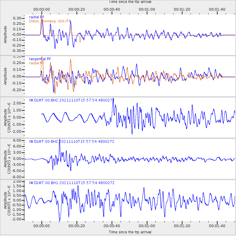
DLMT Dillon, Montana, USA - Earthquake Result Viewer
*The percent match for this event was below the threshold and hence no stack was calculated.
| Earthquake location: |
Southeast Of Ryukyu Islands |
| Earthquake latitude/longitude: |
23.5/126.5 |
| Earthquake time(UTC): |
2021/11/10 (314) 15:45:13 GMT |
| Earthquake Depth: |
10 km |
| Earthquake Magnitude: |
6.6 Mww |
| Earthquake Catalog/Contributor: |
NEIC PDE/us |
|
| Network: |
IW Intermountain West |
| Station: |
DLMT Dillon, Montana, USA |
| Lat/Lon: |
45.36 N/112.60 W |
| Elevation: |
1569 m |
|
| Distance: |
92.9 deg |
| Az: |
37.27 deg |
| Baz: |
307.972 deg |
| Ray Param: |
$rayparam |
*The percent match for this event was below the threshold and hence was not used in the summary stack. |
|
| Radial Match: |
75.11968 % |
| Radial Bump: |
400 |
| Transverse Match: |
60.28324 % |
| Transverse Bump: |
400 |
| SOD ConfigId: |
26694651 |
| Insert Time: |
2021-11-24 16:00:16.494 +0000 |
| GWidth: |
2.5 |
| Max Bumps: |
400 |
| Tol: |
0.001 |
|
Signal To Noise
| Channel | StoN | STA | LTA |
| IW:DLMT:00:BHZ:20211110T15:57:54.480027Z | 3.2967992 | 7.1512005E-7 | 2.1691343E-7 |
| IW:DLMT:00:BH1:20211110T15:57:54.480027Z | 0.46294126 | 1.7116604E-7 | 3.69736E-7 |
| IW:DLMT:00:BH2:20211110T15:57:54.480027Z | 0.82786554 | 3.3967578E-7 | 4.1030307E-7 |
| Arrivals |
| Ps | |
| PpPs | |
| PsPs/PpSs | |


