You are here: Home > Network List > US - United States National Seismic Network Stations List
> Station ELK Elko, Nevada, USA > Earthquake Result Viewer
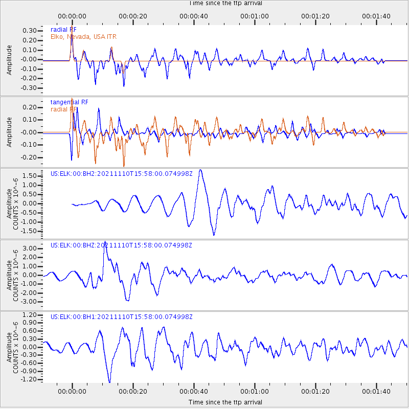
ELK Elko, Nevada, USA - Earthquake Result Viewer
*The percent match for this event was below the threshold and hence no stack was calculated.
| Earthquake location: |
Southeast Of Ryukyu Islands |
| Earthquake latitude/longitude: |
23.5/126.5 |
| Earthquake time(UTC): |
2021/11/10 (314) 15:45:13 GMT |
| Earthquake Depth: |
10 km |
| Earthquake Magnitude: |
6.6 Mww |
| Earthquake Catalog/Contributor: |
NEIC PDE/us |
|
| Network: |
US United States National Seismic Network |
| Station: |
ELK Elko, Nevada, USA |
| Lat/Lon: |
40.74 N/115.24 W |
| Elevation: |
2210 m |
|
| Distance: |
94.1 deg |
| Az: |
42.132 deg |
| Baz: |
305.874 deg |
| Ray Param: |
$rayparam |
*The percent match for this event was below the threshold and hence was not used in the summary stack. |
|
| Radial Match: |
61.614685 % |
| Radial Bump: |
400 |
| Transverse Match: |
61.061882 % |
| Transverse Bump: |
400 |
| SOD ConfigId: |
26694651 |
| Insert Time: |
2021-11-24 16:04:52.825 +0000 |
| GWidth: |
2.5 |
| Max Bumps: |
400 |
| Tol: |
0.001 |
|
Signal To Noise
| Channel | StoN | STA | LTA |
| US:ELK:00:BHZ:20211110T15:58:00.074998Z | 1.6638513 | 6.234232E-7 | 3.7468686E-7 |
| US:ELK:00:BH1:20211110T15:58:00.074998Z | 0.7321854 | 1.4011128E-7 | 1.9136039E-7 |
| US:ELK:00:BH2:20211110T15:58:00.074998Z | 1.563291 | 3.7084888E-7 | 2.3722319E-7 |
| Arrivals |
| Ps | |
| PpPs | |
| PsPs/PpSs | |


