You are here: Home > Network List > G - GEOSCOPE Stations List
> Station MPG Montagne des Peres, French Guyana > Earthquake Result Viewer
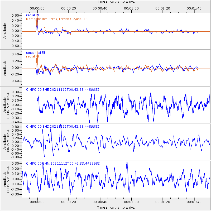
MPG Montagne des Peres, French Guyana - Earthquake Result Viewer
*The percent match for this event was below the threshold and hence no stack was calculated.
| Earthquake location: |
Southern Mid-Atlantic Ridge |
| Earthquake latitude/longitude: |
-26.5/-13.7 |
| Earthquake time(UTC): |
2021/11/12 (316) 00:34:16 GMT |
| Earthquake Depth: |
10 km |
| Earthquake Magnitude: |
5.8 mww |
| Earthquake Catalog/Contributor: |
NEIC PDE/us |
|
| Network: |
G GEOSCOPE |
| Station: |
MPG Montagne des Peres, French Guyana |
| Lat/Lon: |
5.11 N/52.64 W |
| Elevation: |
147 m |
|
| Distance: |
49.1 deg |
| Az: |
304.063 deg |
| Baz: |
131.833 deg |
| Ray Param: |
$rayparam |
*The percent match for this event was below the threshold and hence was not used in the summary stack. |
|
| Radial Match: |
76.389206 % |
| Radial Bump: |
400 |
| Transverse Match: |
62.382557 % |
| Transverse Bump: |
400 |
| SOD ConfigId: |
26694651 |
| Insert Time: |
2021-11-26 00:38:11.765 +0000 |
| GWidth: |
2.5 |
| Max Bumps: |
400 |
| Tol: |
0.001 |
|
Signal To Noise
| Channel | StoN | STA | LTA |
| G:MPG:00:BHZ:20211112T00:42:33.448998Z | 2.4085855 | 3.2258112E-7 | 1.3392969E-7 |
| G:MPG:00:BHN:20211112T00:42:33.448998Z | 1.6288936 | 1.7434516E-7 | 1.07032875E-7 |
| G:MPG:00:BHE:20211112T00:42:33.448998Z | 1.6781759 | 1.6540145E-7 | 9.856026E-8 |
| Arrivals |
| Ps | |
| PpPs | |
| PsPs/PpSs | |


