You are here: Home > Network List > US - United States National Seismic Network Stations List
> Station ERPA Erie, Pennsylvania, USA > Earthquake Result Viewer
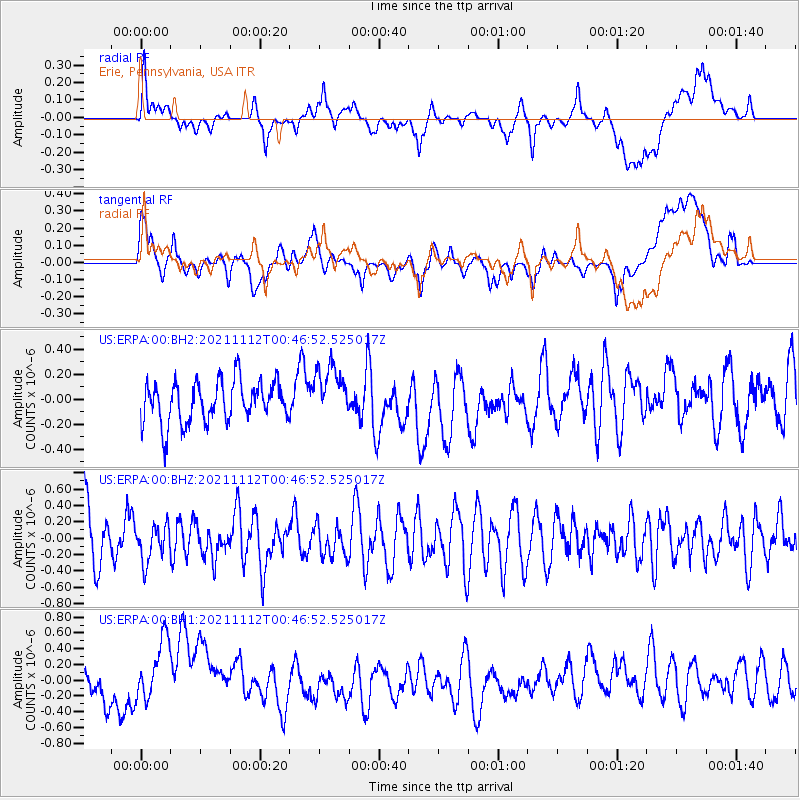
ERPA Erie, Pennsylvania, USA - Earthquake Result Viewer
*The percent match for this event was below the threshold and hence no stack was calculated.
| Earthquake location: |
Southern Mid-Atlantic Ridge |
| Earthquake latitude/longitude: |
-26.5/-13.7 |
| Earthquake time(UTC): |
2021/11/12 (316) 00:34:16 GMT |
| Earthquake Depth: |
10 km |
| Earthquake Magnitude: |
5.8 mww |
| Earthquake Catalog/Contributor: |
NEIC PDE/us |
|
| Network: |
US United States National Seismic Network |
| Station: |
ERPA Erie, Pennsylvania, USA |
| Lat/Lon: |
42.12 N/79.99 W |
| Elevation: |
306 m |
|
| Distance: |
91.7 deg |
| Az: |
317.035 deg |
| Baz: |
124.848 deg |
| Ray Param: |
$rayparam |
*The percent match for this event was below the threshold and hence was not used in the summary stack. |
|
| Radial Match: |
43.40237 % |
| Radial Bump: |
400 |
| Transverse Match: |
45.24506 % |
| Transverse Bump: |
400 |
| SOD ConfigId: |
26694651 |
| Insert Time: |
2021-11-26 00:43:15.982 +0000 |
| GWidth: |
2.5 |
| Max Bumps: |
400 |
| Tol: |
0.001 |
|
Signal To Noise
| Channel | StoN | STA | LTA |
| US:ERPA:00:BHZ:20211112T00:46:52.525017Z | 0.7220493 | 2.229497E-7 | 3.087735E-7 |
| US:ERPA:00:BH1:20211112T00:46:52.525017Z | 1.9893683 | 4.450772E-7 | 2.2372791E-7 |
| US:ERPA:00:BH2:20211112T00:46:52.525017Z | 1.3052003 | 2.1711317E-7 | 1.663447E-7 |
| Arrivals |
| Ps | |
| PpPs | |
| PsPs/PpSs | |


