You are here: Home > Network List > US - United States National Seismic Network Stations List
> Station DUG Dugway, Tooele County, Utah, USA > Earthquake Result Viewer
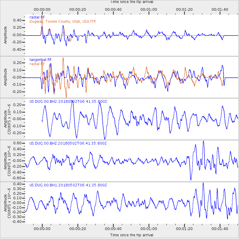
DUG Dugway, Tooele County, Utah, USA - Earthquake Result Viewer
*The percent match for this event was below the threshold and hence no stack was calculated.
| Earthquake location: |
Easter Island Region |
| Earthquake latitude/longitude: |
-24.3/-112.1 |
| Earthquake time(UTC): |
2018/05/02 (122) 06:31:32 GMT |
| Earthquake Depth: |
10 km |
| Earthquake Magnitude: |
5.5 mb |
| Earthquake Catalog/Contributor: |
NEIC PDE/us |
|
| Network: |
US United States National Seismic Network |
| Station: |
DUG Dugway, Tooele County, Utah, USA |
| Lat/Lon: |
40.19 N/112.81 W |
| Elevation: |
1477 m |
|
| Distance: |
64.1 deg |
| Az: |
359.425 deg |
| Baz: |
179.314 deg |
| Ray Param: |
$rayparam |
*The percent match for this event was below the threshold and hence was not used in the summary stack. |
|
| Radial Match: |
64.196915 % |
| Radial Bump: |
400 |
| Transverse Match: |
48.21942 % |
| Transverse Bump: |
400 |
| SOD ConfigId: |
2665671 |
| Insert Time: |
2018-05-16 06:40:02.523 +0000 |
| GWidth: |
2.5 |
| Max Bumps: |
400 |
| Tol: |
0.001 |
|
Signal To Noise
| Channel | StoN | STA | LTA |
| US:DUG:00:BHZ:20180502T06:41:35.800Z | 1.4177041 | 1.4222083E-7 | 1.003177E-7 |
| US:DUG:00:BH1:20180502T06:41:35.800Z | 0.72642225 | 6.480064E-8 | 8.920519E-8 |
| US:DUG:00:BH2:20180502T06:41:35.800Z | 1.1699184 | 1.4029325E-7 | 1.1991712E-7 |
| Arrivals |
| Ps | |
| PpPs | |
| PsPs/PpSs | |


