You are here: Home > Network List > US - United States National Seismic Network Stations List
> Station WMOK Wichita Mountains, Oklahoma, USA > Earthquake Result Viewer
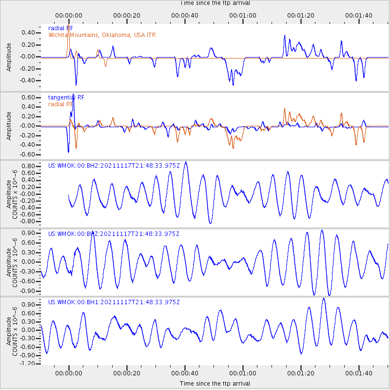
WMOK Wichita Mountains, Oklahoma, USA - Earthquake Result Viewer
*The percent match for this event was below the threshold and hence no stack was calculated.
| Earthquake location: |
Santiago Del Estero Prov., Arg. |
| Earthquake latitude/longitude: |
-26.3/-63.3 |
| Earthquake time(UTC): |
2021/11/17 (321) 21:38:53 GMT |
| Earthquake Depth: |
570 km |
| Earthquake Magnitude: |
5.5 mww |
| Earthquake Catalog/Contributor: |
NEIC PDE/us |
|
| Network: |
US United States National Seismic Network |
| Station: |
WMOK Wichita Mountains, Oklahoma, USA |
| Lat/Lon: |
34.74 N/98.78 W |
| Elevation: |
486 m |
|
| Distance: |
69.4 deg |
| Az: |
329.325 deg |
| Baz: |
146.226 deg |
| Ray Param: |
$rayparam |
*The percent match for this event was below the threshold and hence was not used in the summary stack. |
|
| Radial Match: |
49.931427 % |
| Radial Bump: |
400 |
| Transverse Match: |
77.97339 % |
| Transverse Bump: |
400 |
| SOD ConfigId: |
26694651 |
| Insert Time: |
2021-12-01 21:53:58.121 +0000 |
| GWidth: |
2.5 |
| Max Bumps: |
400 |
| Tol: |
0.001 |
|
Signal To Noise
| Channel | StoN | STA | LTA |
| US:WMOK:00:BHZ:20211117T21:48:33.975Z | 0.8667101 | 2.8497476E-7 | 3.2880052E-7 |
| US:WMOK:00:BH1:20211117T21:48:33.975Z | 1.3460618 | 4.3023226E-7 | 3.1962298E-7 |
| US:WMOK:00:BH2:20211117T21:48:33.975Z | 1.614286 | 4.1071755E-7 | 2.5442677E-7 |
| Arrivals |
| Ps | |
| PpPs | |
| PsPs/PpSs | |


