You are here: Home > Network List > AV - Alaska Volcano Observatory Stations List
> Station AMKA Regional Station, Amchitka Island, Alaska > Earthquake Result Viewer
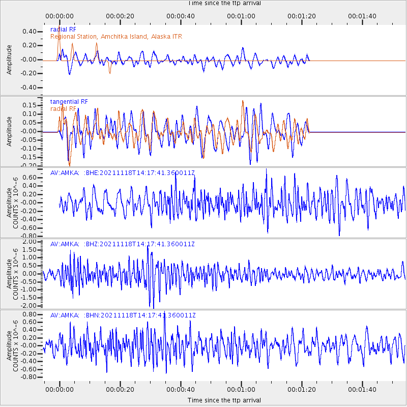
AMKA Regional Station, Amchitka Island, Alaska - Earthquake Result Viewer
*The percent match for this event was below the threshold and hence no stack was calculated.
| Earthquake location: |
New Ireland Region, P.N.G. |
| Earthquake latitude/longitude: |
-5.3/153.7 |
| Earthquake time(UTC): |
2021/11/18 (322) 14:08:05 GMT |
| Earthquake Depth: |
35 km |
| Earthquake Magnitude: |
6.2 mww |
| Earthquake Catalog/Contributor: |
NEIC PDE/us |
|
| Network: |
AV Alaska Volcano Observatory |
| Station: |
AMKA Regional Station, Amchitka Island, Alaska |
| Lat/Lon: |
51.38 N/179.30 E |
| Elevation: |
116 m |
|
| Distance: |
60.6 deg |
| Az: |
18.091 deg |
| Baz: |
209.562 deg |
| Ray Param: |
$rayparam |
*The percent match for this event was below the threshold and hence was not used in the summary stack. |
|
| Radial Match: |
38.497444 % |
| Radial Bump: |
338 |
| Transverse Match: |
57.98882 % |
| Transverse Bump: |
370 |
| SOD ConfigId: |
26694651 |
| Insert Time: |
2021-12-02 14:14:23.446 +0000 |
| GWidth: |
2.5 |
| Max Bumps: |
400 |
| Tol: |
0.001 |
|
Signal To Noise
| Channel | StoN | STA | LTA |
| AV:AMKA: :BHZ:20211118T14:17:41.360011Z | 2.9735775 | 5.870241E-7 | 1.9741343E-7 |
| AV:AMKA: :BHN:20211118T14:17:41.360011Z | 1.4716153 | 2.4802873E-7 | 1.6854183E-7 |
| AV:AMKA: :BHE:20211118T14:17:41.360011Z | 1.1008538 | 2.1616508E-7 | 1.9636128E-7 |
| Arrivals |
| Ps | |
| PpPs | |
| PsPs/PpSs | |


