You are here: Home > Network List > US - United States National Seismic Network Stations List
> Station EGMT Eagleton, Montana, USA > Earthquake Result Viewer
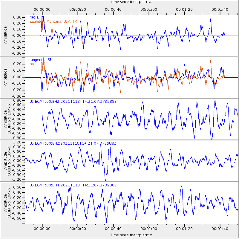
EGMT Eagleton, Montana, USA - Earthquake Result Viewer
*The percent match for this event was below the threshold and hence no stack was calculated.
| Earthquake location: |
New Ireland Region, P.N.G. |
| Earthquake latitude/longitude: |
-5.3/153.7 |
| Earthquake time(UTC): |
2021/11/18 (322) 14:08:05 GMT |
| Earthquake Depth: |
35 km |
| Earthquake Magnitude: |
6.2 mww |
| Earthquake Catalog/Contributor: |
NEIC PDE/us |
|
| Network: |
US United States National Seismic Network |
| Station: |
EGMT Eagleton, Montana, USA |
| Lat/Lon: |
48.02 N/109.75 W |
| Elevation: |
1055 m |
|
| Distance: |
98.3 deg |
| Az: |
42.376 deg |
| Baz: |
271.269 deg |
| Ray Param: |
$rayparam |
*The percent match for this event was below the threshold and hence was not used in the summary stack. |
|
| Radial Match: |
60.61981 % |
| Radial Bump: |
396 |
| Transverse Match: |
54.468903 % |
| Transverse Bump: |
400 |
| SOD ConfigId: |
26694651 |
| Insert Time: |
2021-12-02 14:29:48.007 +0000 |
| GWidth: |
2.5 |
| Max Bumps: |
400 |
| Tol: |
0.001 |
|
Signal To Noise
| Channel | StoN | STA | LTA |
| US:EGMT:00:BHZ:20211118T14:21:07.373988Z | 3.2370155 | 3.7877848E-7 | 1.1701473E-7 |
| US:EGMT:00:BH1:20211118T14:21:07.373988Z | 0.56970364 | 1.7819724E-7 | 3.1278935E-7 |
| US:EGMT:00:BH2:20211118T14:21:07.373988Z | 1.1295509 | 2.9885234E-7 | 2.6457624E-7 |
| Arrivals |
| Ps | |
| PpPs | |
| PsPs/PpSs | |


