You are here: Home > Network List > US - United States National Seismic Network Stations List
> Station HAWA Hanford, Washington, USA > Earthquake Result Viewer
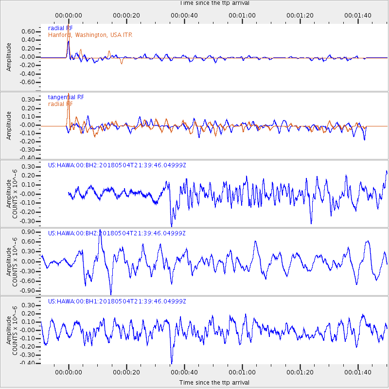
HAWA Hanford, Washington, USA - Earthquake Result Viewer
*The percent match for this event was below the threshold and hence no stack was calculated.
| Earthquake location: |
Hawaii |
| Earthquake latitude/longitude: |
19.3/-155.0 |
| Earthquake time(UTC): |
2018/05/04 (124) 21:32:44 GMT |
| Earthquake Depth: |
6.9 km |
| Earthquake Magnitude: |
5.7 Ml |
| Earthquake Catalog/Contributor: |
NEIC PDE/hv |
|
| Network: |
US United States National Seismic Network |
| Station: |
HAWA Hanford, Washington, USA |
| Lat/Lon: |
46.39 N/119.53 W |
| Elevation: |
364 m |
|
| Distance: |
39.7 deg |
| Az: |
39.018 deg |
| Baz: |
239.192 deg |
| Ray Param: |
$rayparam |
*The percent match for this event was below the threshold and hence was not used in the summary stack. |
|
| Radial Match: |
71.96693 % |
| Radial Bump: |
400 |
| Transverse Match: |
42.425705 % |
| Transverse Bump: |
400 |
| SOD ConfigId: |
2665671 |
| Insert Time: |
2018-05-18 21:39:14.240 +0000 |
| GWidth: |
2.5 |
| Max Bumps: |
400 |
| Tol: |
0.001 |
|
Signal To Noise
| Channel | StoN | STA | LTA |
| US:HAWA:00:BHZ:20180504T21:39:46.04999Z | 2.1672146 | 1.8599536E-7 | 8.582231E-8 |
| US:HAWA:00:BH1:20180504T21:39:46.04999Z | 0.7900564 | 6.7698515E-8 | 8.568821E-8 |
| US:HAWA:00:BH2:20180504T21:39:46.04999Z | 2.2514584 | 7.890826E-8 | 3.504762E-8 |
| Arrivals |
| Ps | |
| PpPs | |
| PsPs/PpSs | |


