You are here: Home > Network List > UW - Pacific Northwest Regional Seismic Network Stations List
> Station UMAT Pilot Rock, OR, USA > Earthquake Result Viewer
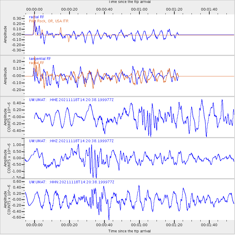
UMAT Pilot Rock, OR, USA - Earthquake Result Viewer
*The percent match for this event was below the threshold and hence no stack was calculated.
| Earthquake location: |
New Ireland Region, P.N.G. |
| Earthquake latitude/longitude: |
-5.3/153.7 |
| Earthquake time(UTC): |
2021/11/18 (322) 14:08:05 GMT |
| Earthquake Depth: |
35 km |
| Earthquake Magnitude: |
6.2 mww |
| Earthquake Catalog/Contributor: |
NEIC PDE/us |
|
| Network: |
UW Pacific Northwest Regional Seismic Network |
| Station: |
UMAT Pilot Rock, OR, USA |
| Lat/Lon: |
45.29 N/118.96 W |
| Elevation: |
1318 m |
|
| Distance: |
91.8 deg |
| Az: |
44.868 deg |
| Baz: |
264.367 deg |
| Ray Param: |
$rayparam |
*The percent match for this event was below the threshold and hence was not used in the summary stack. |
|
| Radial Match: |
62.53411 % |
| Radial Bump: |
400 |
| Transverse Match: |
70.81496 % |
| Transverse Bump: |
400 |
| SOD ConfigId: |
26694651 |
| Insert Time: |
2021-12-02 14:32:06.587 +0000 |
| GWidth: |
2.5 |
| Max Bumps: |
400 |
| Tol: |
0.001 |
|
Signal To Noise
| Channel | StoN | STA | LTA |
| UW:UMAT: :HHZ:20211118T14:20:38.199977Z | 2.531864 | 4.444053E-7 | 1.7552495E-7 |
| UW:UMAT: :HHN:20211118T14:20:38.199977Z | 1.1338016 | 1.7359375E-7 | 1.5310769E-7 |
| UW:UMAT: :HHE:20211118T14:20:38.199977Z | 1.5175104 | 2.1771045E-7 | 1.4346554E-7 |
| Arrivals |
| Ps | |
| PpPs | |
| PsPs/PpSs | |


