You are here: Home > Network List > AZ - ANZA Regional Network Stations List
> Station LVA2 AZ.LVA2 > Earthquake Result Viewer
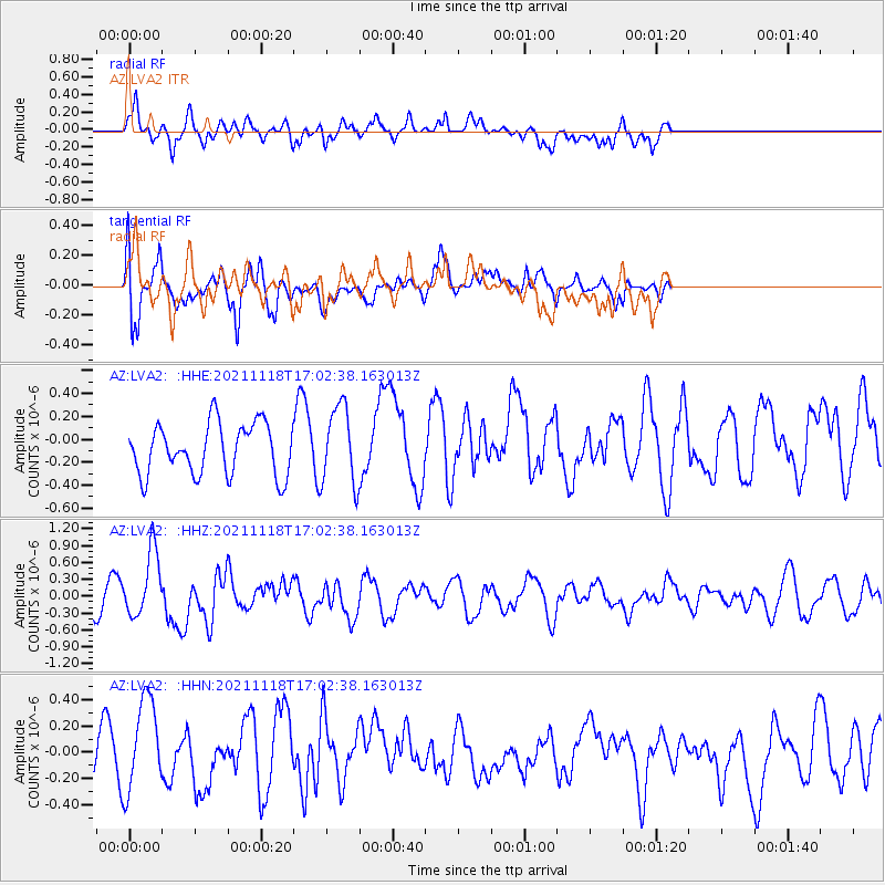
LVA2 AZ.LVA2 - Earthquake Result Viewer
*The percent match for this event was below the threshold and hence no stack was calculated.
| Earthquake location: |
Near Coast Of Guatemala |
| Earthquake latitude/longitude: |
13.6/-90.8 |
| Earthquake time(UTC): |
2021/11/18 (322) 16:56:56 GMT |
| Earthquake Depth: |
30 km |
| Earthquake Magnitude: |
5.8 Mww |
| Earthquake Catalog/Contributor: |
NEIC PDE/us |
|
| Network: |
AZ ANZA Regional Network |
| Station: |
LVA2 AZ.LVA2 |
| Lat/Lon: |
33.35 N/116.56 W |
| Elevation: |
1435 m |
|
| Distance: |
30.6 deg |
| Az: |
314.434 deg |
| Baz: |
123.935 deg |
| Ray Param: |
$rayparam |
*The percent match for this event was below the threshold and hence was not used in the summary stack. |
|
| Radial Match: |
62.95417 % |
| Radial Bump: |
400 |
| Transverse Match: |
62.055775 % |
| Transverse Bump: |
400 |
| SOD ConfigId: |
26694651 |
| Insert Time: |
2021-12-02 17:00:49.927 +0000 |
| GWidth: |
2.5 |
| Max Bumps: |
400 |
| Tol: |
0.001 |
|
Signal To Noise
| Channel | StoN | STA | LTA |
| AZ:LVA2: :HHZ:20211118T17:02:38.163013Z | 4.5263944 | 5.865191E-7 | 1.2957754E-7 |
| AZ:LVA2: :HHN:20211118T17:02:38.163013Z | 1.3139064 | 3.5441076E-7 | 2.697382E-7 |
| AZ:LVA2: :HHE:20211118T17:02:38.163013Z | 1.5347462 | 3.41435E-7 | 2.2247002E-7 |
| Arrivals |
| Ps | |
| PpPs | |
| PsPs/PpSs | |


