You are here: Home > Network List > AZ - ANZA Regional Network Stations List
> Station SMER AZ.SMER > Earthquake Result Viewer
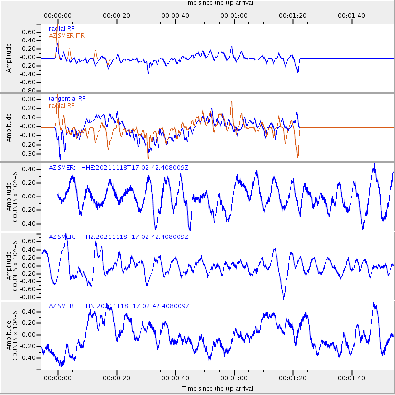
SMER AZ.SMER - Earthquake Result Viewer
*The percent match for this event was below the threshold and hence no stack was calculated.
| Earthquake location: |
Near Coast Of Guatemala |
| Earthquake latitude/longitude: |
13.6/-90.8 |
| Earthquake time(UTC): |
2021/11/18 (322) 16:56:56 GMT |
| Earthquake Depth: |
30 km |
| Earthquake Magnitude: |
5.8 Mww |
| Earthquake Catalog/Contributor: |
NEIC PDE/us |
|
| Network: |
AZ ANZA Regional Network |
| Station: |
SMER AZ.SMER |
| Lat/Lon: |
33.46 N/117.17 W |
| Elevation: |
355 m |
|
| Distance: |
31.1 deg |
| Az: |
314.056 deg |
| Baz: |
123.276 deg |
| Ray Param: |
$rayparam |
*The percent match for this event was below the threshold and hence was not used in the summary stack. |
|
| Radial Match: |
40.79459 % |
| Radial Bump: |
400 |
| Transverse Match: |
34.440144 % |
| Transverse Bump: |
400 |
| SOD ConfigId: |
26694651 |
| Insert Time: |
2021-12-02 17:00:54.639 +0000 |
| GWidth: |
2.5 |
| Max Bumps: |
400 |
| Tol: |
0.001 |
|
Signal To Noise
| Channel | StoN | STA | LTA |
| AZ:SMER: :HHZ:20211118T17:02:42.408009Z | 1.6946923 | 4.2518244E-7 | 2.5089065E-7 |
| AZ:SMER: :HHN:20211118T17:02:42.408009Z | 1.6407753 | 4.8761905E-7 | 2.9718817E-7 |
| AZ:SMER: :HHE:20211118T17:02:42.408009Z | 2.0775876 | 2.605496E-7 | 1.2540968E-7 |
| Arrivals |
| Ps | |
| PpPs | |
| PsPs/PpSs | |


