You are here: Home > Network List > G - GEOSCOPE Stations List
> Station TAM Tamanrasset, Algeria > Earthquake Result Viewer
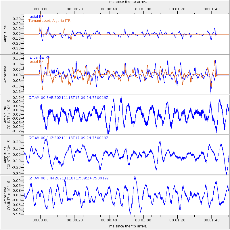
TAM Tamanrasset, Algeria - Earthquake Result Viewer
*The percent match for this event was below the threshold and hence no stack was calculated.
| Earthquake location: |
Near Coast Of Guatemala |
| Earthquake latitude/longitude: |
13.6/-90.8 |
| Earthquake time(UTC): |
2021/11/18 (322) 16:56:56 GMT |
| Earthquake Depth: |
30 km |
| Earthquake Magnitude: |
5.8 Mww |
| Earthquake Catalog/Contributor: |
NEIC PDE/us |
|
| Network: |
G GEOSCOPE |
| Station: |
TAM Tamanrasset, Algeria |
| Lat/Lon: |
22.79 N/5.53 E |
| Elevation: |
1377 m |
|
| Distance: |
90.5 deg |
| Az: |
66.53 deg |
| Baz: |
284.842 deg |
| Ray Param: |
$rayparam |
*The percent match for this event was below the threshold and hence was not used in the summary stack. |
|
| Radial Match: |
42.558517 % |
| Radial Bump: |
400 |
| Transverse Match: |
48.514908 % |
| Transverse Bump: |
400 |
| SOD ConfigId: |
26694651 |
| Insert Time: |
2021-12-02 17:05:34.764 +0000 |
| GWidth: |
2.5 |
| Max Bumps: |
400 |
| Tol: |
0.001 |
|
Signal To Noise
| Channel | StoN | STA | LTA |
| G:TAM:00:BHZ:20211118T17:09:24.750019Z | 1.931875 | 1.5254005E-7 | 7.895959E-8 |
| G:TAM:00:BHN:20211118T17:09:24.750019Z | 1.0935518 | 4.5226205E-8 | 4.135717E-8 |
| G:TAM:00:BHE:20211118T17:09:24.750019Z | 0.82630557 | 2.9260502E-8 | 3.5411237E-8 |
| Arrivals |
| Ps | |
| PpPs | |
| PsPs/PpSs | |


