You are here: Home > Network List > CI - Caltech Regional Seismic Network Stations List
> Station MPM Manuel Prospect Mine, California, USA > Earthquake Result Viewer
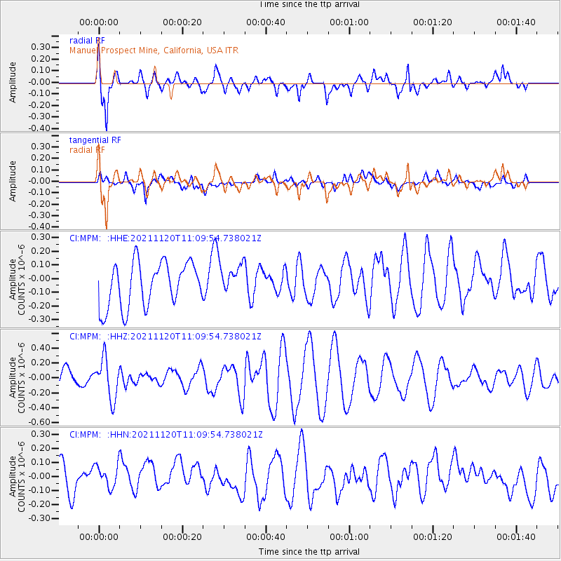
MPM Manuel Prospect Mine, California, USA - Earthquake Result Viewer
*The percent match for this event was below the threshold and hence no stack was calculated.
| Earthquake location: |
Vanuatu Islands |
| Earthquake latitude/longitude: |
-15.6/167.6 |
| Earthquake time(UTC): |
2021/11/20 (324) 10:57:53 GMT |
| Earthquake Depth: |
129 km |
| Earthquake Magnitude: |
5.5 mww |
| Earthquake Catalog/Contributor: |
NEIC PDE/us |
|
| Network: |
CI Caltech Regional Seismic Network |
| Station: |
MPM Manuel Prospect Mine, California, USA |
| Lat/Lon: |
36.06 N/117.49 W |
| Elevation: |
185 m |
|
| Distance: |
87.3 deg |
| Az: |
51.558 deg |
| Baz: |
248.659 deg |
| Ray Param: |
$rayparam |
*The percent match for this event was below the threshold and hence was not used in the summary stack. |
|
| Radial Match: |
66.10895 % |
| Radial Bump: |
400 |
| Transverse Match: |
49.160225 % |
| Transverse Bump: |
400 |
| SOD ConfigId: |
26694651 |
| Insert Time: |
2021-12-04 11:06:19.969 +0000 |
| GWidth: |
2.5 |
| Max Bumps: |
400 |
| Tol: |
0.001 |
|
Signal To Noise
| Channel | StoN | STA | LTA |
| CI:MPM: :HHZ:20211120T11:09:54.738021Z | 1.3512037 | 2.7363393E-7 | 2.0251123E-7 |
| CI:MPM: :HHN:20211120T11:09:54.738021Z | 0.97690666 | 1.0261822E-7 | 1.0504404E-7 |
| CI:MPM: :HHE:20211120T11:09:54.738021Z | 0.6462511 | 1.05266935E-7 | 1.628886E-7 |
| Arrivals |
| Ps | |
| PpPs | |
| PsPs/PpSs | |


