You are here: Home > Network List > IU - Global Seismograph Network (GSN - IRIS/USGS) Stations List
> Station JOHN Johnston Island, USA > Earthquake Result Viewer
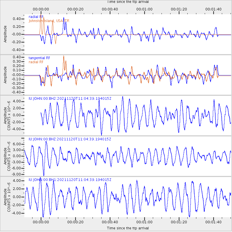
JOHN Johnston Island, USA - Earthquake Result Viewer
*The percent match for this event was below the threshold and hence no stack was calculated.
| Earthquake location: |
Vanuatu Islands |
| Earthquake latitude/longitude: |
-15.6/167.6 |
| Earthquake time(UTC): |
2021/11/20 (324) 10:57:53 GMT |
| Earthquake Depth: |
129 km |
| Earthquake Magnitude: |
5.5 mww |
| Earthquake Catalog/Contributor: |
NEIC PDE/us |
|
| Network: |
IU Global Seismograph Network (GSN - IRIS/USGS) |
| Station: |
JOHN Johnston Island, USA |
| Lat/Lon: |
16.73 N/169.53 W |
| Elevation: |
2.0 m |
|
| Distance: |
39.3 deg |
| Az: |
36.054 deg |
| Baz: |
216.291 deg |
| Ray Param: |
$rayparam |
*The percent match for this event was below the threshold and hence was not used in the summary stack. |
|
| Radial Match: |
70.30084 % |
| Radial Bump: |
400 |
| Transverse Match: |
66.18721 % |
| Transverse Bump: |
400 |
| SOD ConfigId: |
26694651 |
| Insert Time: |
2021-12-04 11:09:11.667 +0000 |
| GWidth: |
2.5 |
| Max Bumps: |
400 |
| Tol: |
0.001 |
|
Signal To Noise
| Channel | StoN | STA | LTA |
| IU:JOHN:00:BHZ:20211120T11:04:39.194015Z | 2.131179 | 4.8870243E-6 | 2.2931083E-6 |
| IU:JOHN:00:BH1:20211120T11:04:39.194015Z | 1.3671342 | 3.08357E-6 | 2.255499E-6 |
| IU:JOHN:00:BH2:20211120T11:04:39.194015Z | 0.8599438 | 2.0211735E-6 | 2.3503553E-6 |
| Arrivals |
| Ps | |
| PpPs | |
| PsPs/PpSs | |


