You are here: Home > Network List > IW - Intermountain West Stations List
> Station MOOW Moose Ponds, Wyoming, USA > Earthquake Result Viewer
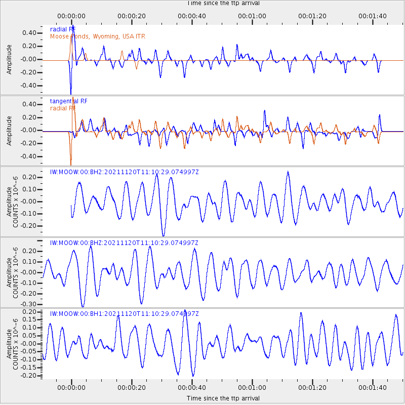
MOOW Moose Ponds, Wyoming, USA - Earthquake Result Viewer
*The percent match for this event was below the threshold and hence no stack was calculated.
| Earthquake location: |
Vanuatu Islands |
| Earthquake latitude/longitude: |
-15.6/167.6 |
| Earthquake time(UTC): |
2021/11/20 (324) 10:57:53 GMT |
| Earthquake Depth: |
129 km |
| Earthquake Magnitude: |
5.5 mww |
| Earthquake Catalog/Contributor: |
NEIC PDE/us |
|
| Network: |
IW Intermountain West |
| Station: |
MOOW Moose Ponds, Wyoming, USA |
| Lat/Lon: |
43.75 N/110.74 W |
| Elevation: |
2128 m |
|
| Distance: |
94.8 deg |
| Az: |
46.014 deg |
| Baz: |
253.083 deg |
| Ray Param: |
$rayparam |
*The percent match for this event was below the threshold and hence was not used in the summary stack. |
|
| Radial Match: |
49.14632 % |
| Radial Bump: |
400 |
| Transverse Match: |
56.746326 % |
| Transverse Bump: |
400 |
| SOD ConfigId: |
26694651 |
| Insert Time: |
2021-12-04 11:09:30.897 +0000 |
| GWidth: |
2.5 |
| Max Bumps: |
400 |
| Tol: |
0.001 |
|
Signal To Noise
| Channel | StoN | STA | LTA |
| IW:MOOW:00:BHZ:20211120T11:10:29.074997Z | 2.1665773 | 1.9406498E-7 | 8.957214E-8 |
| IW:MOOW:00:BH1:20211120T11:10:29.074997Z | 0.5828084 | 4.423147E-8 | 7.5893674E-8 |
| IW:MOOW:00:BH2:20211120T11:10:29.074997Z | 1.8396814 | 1.648399E-7 | 8.960242E-8 |
| Arrivals |
| Ps | |
| PpPs | |
| PsPs/PpSs | |


