You are here: Home > Network List > US - United States National Seismic Network Stations List
> Station MNTX Cornudas Mountains, Texas, USA > Earthquake Result Viewer
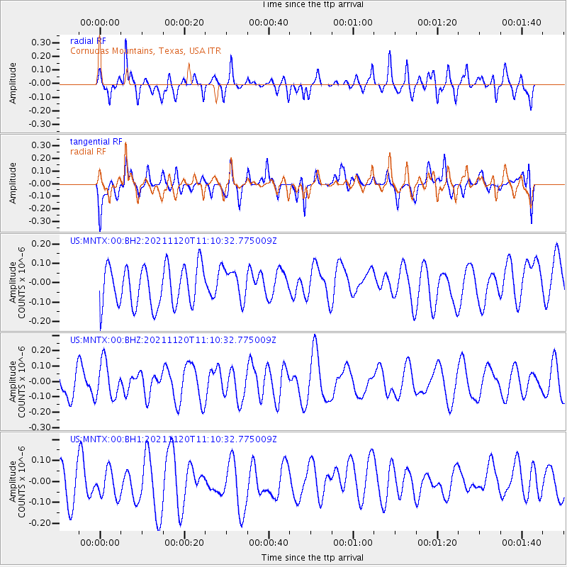
MNTX Cornudas Mountains, Texas, USA - Earthquake Result Viewer
*The percent match for this event was below the threshold and hence no stack was calculated.
| Earthquake location: |
Vanuatu Islands |
| Earthquake latitude/longitude: |
-15.6/167.6 |
| Earthquake time(UTC): |
2021/11/20 (324) 10:57:53 GMT |
| Earthquake Depth: |
129 km |
| Earthquake Magnitude: |
5.5 mww |
| Earthquake Catalog/Contributor: |
NEIC PDE/us |
|
| Network: |
US United States National Seismic Network |
| Station: |
MNTX Cornudas Mountains, Texas, USA |
| Lat/Lon: |
31.70 N/105.38 W |
| Elevation: |
405 m |
|
| Distance: |
95.6 deg |
| Az: |
58.792 deg |
| Baz: |
255.215 deg |
| Ray Param: |
$rayparam |
*The percent match for this event was below the threshold and hence was not used in the summary stack. |
|
| Radial Match: |
59.96343 % |
| Radial Bump: |
341 |
| Transverse Match: |
37.72865 % |
| Transverse Bump: |
400 |
| SOD ConfigId: |
26694651 |
| Insert Time: |
2021-12-04 11:13:44.166 +0000 |
| GWidth: |
2.5 |
| Max Bumps: |
400 |
| Tol: |
0.001 |
|
Signal To Noise
| Channel | StoN | STA | LTA |
| US:MNTX:00:BHZ:20211120T11:10:32.775009Z | 1.7237717 | 1.17262324E-7 | 6.8026594E-8 |
| US:MNTX:00:BH1:20211120T11:10:32.775009Z | 1.0588871 | 7.235669E-8 | 6.833277E-8 |
| US:MNTX:00:BH2:20211120T11:10:32.775009Z | 0.76663214 | 7.886262E-8 | 1.0286891E-7 |
| Arrivals |
| Ps | |
| PpPs | |
| PsPs/PpSs | |


