You are here: Home > Network List > AZ - ANZA Regional Network Stations List
> Station SMER AZ.SMER > Earthquake Result Viewer
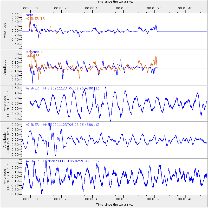
SMER AZ.SMER - Earthquake Result Viewer
*The percent match for this event was below the threshold and hence no stack was calculated.
| Earthquake location: |
Near Coast Of Guatemala |
| Earthquake latitude/longitude: |
13.0/-90.2 |
| Earthquake time(UTC): |
2021/11/23 (327) 05:56:36 GMT |
| Earthquake Depth: |
49 km |
| Earthquake Magnitude: |
5.4 mww |
| Earthquake Catalog/Contributor: |
NEIC PDE/us |
|
| Network: |
AZ ANZA Regional Network |
| Station: |
SMER AZ.SMER |
| Lat/Lon: |
33.46 N/117.17 W |
| Elevation: |
355 m |
|
| Distance: |
31.9 deg |
| Az: |
314.196 deg |
| Baz: |
123.292 deg |
| Ray Param: |
$rayparam |
*The percent match for this event was below the threshold and hence was not used in the summary stack. |
|
| Radial Match: |
77.68778 % |
| Radial Bump: |
400 |
| Transverse Match: |
78.73584 % |
| Transverse Bump: |
254 |
| SOD ConfigId: |
26694651 |
| Insert Time: |
2021-12-07 06:00:50.278 +0000 |
| GWidth: |
2.5 |
| Max Bumps: |
400 |
| Tol: |
0.001 |
|
Signal To Noise
| Channel | StoN | STA | LTA |
| AZ:SMER: :HHZ:20211123T06:02:26.438011Z | 1.9906768 | 4.6209868E-7 | 2.3213146E-7 |
| AZ:SMER: :HHN:20211123T06:02:26.438011Z | 1.1773392 | 1.6941601E-7 | 1.4389737E-7 |
| AZ:SMER: :HHE:20211123T06:02:26.438011Z | 1.7771449 | 3.6539274E-7 | 2.0560661E-7 |
| Arrivals |
| Ps | |
| PpPs | |
| PsPs/PpSs | |


