You are here: Home > Network List > CI - Caltech Regional Seismic Network Stations List
> Station MPP McPhearson Peak > Earthquake Result Viewer
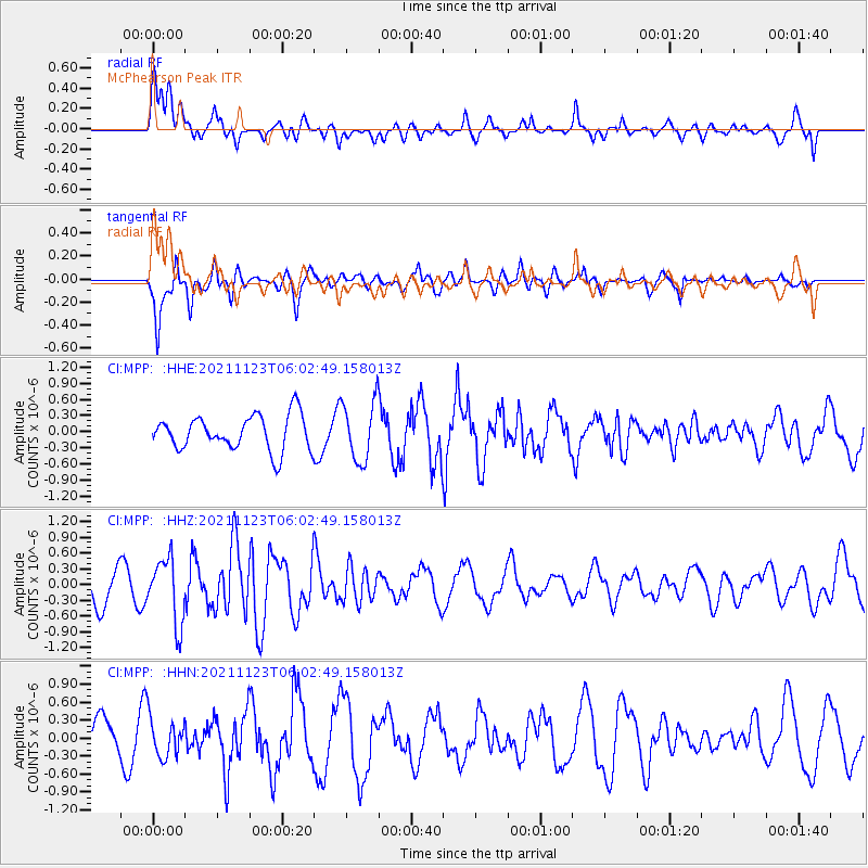
MPP McPhearson Peak - Earthquake Result Viewer
*The percent match for this event was below the threshold and hence no stack was calculated.
| Earthquake location: |
Near Coast Of Guatemala |
| Earthquake latitude/longitude: |
13.0/-90.2 |
| Earthquake time(UTC): |
2021/11/23 (327) 05:56:36 GMT |
| Earthquake Depth: |
49 km |
| Earthquake Magnitude: |
5.4 mww |
| Earthquake Catalog/Contributor: |
NEIC PDE/us |
|
| Network: |
CI Caltech Regional Seismic Network |
| Station: |
MPP McPhearson Peak |
| Lat/Lon: |
34.89 N/119.81 W |
| Elevation: |
1739 m |
|
| Distance: |
34.5 deg |
| Az: |
314.238 deg |
| Baz: |
121.849 deg |
| Ray Param: |
$rayparam |
*The percent match for this event was below the threshold and hence was not used in the summary stack. |
|
| Radial Match: |
61.556267 % |
| Radial Bump: |
400 |
| Transverse Match: |
57.324493 % |
| Transverse Bump: |
396 |
| SOD ConfigId: |
26694651 |
| Insert Time: |
2021-12-07 06:03:43.884 +0000 |
| GWidth: |
2.5 |
| Max Bumps: |
400 |
| Tol: |
0.001 |
|
Signal To Noise
| Channel | StoN | STA | LTA |
| CI:MPP: :HHZ:20211123T06:02:49.158013Z | 2.0561466 | 6.1119675E-7 | 2.9725345E-7 |
| CI:MPP: :HHN:20211123T06:02:49.158013Z | 1.0580438 | 3.2404168E-7 | 3.062649E-7 |
| CI:MPP: :HHE:20211123T06:02:49.158013Z | 1.7330297 | 5.5595376E-7 | 3.2079873E-7 |
| Arrivals |
| Ps | |
| PpPs | |
| PsPs/PpSs | |


