You are here: Home > Network List > US - United States National Seismic Network Stations List
> Station EGMT Eagleton, Montana, USA > Earthquake Result Viewer
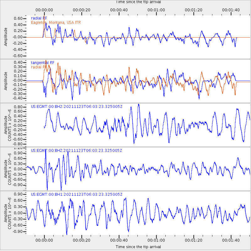
EGMT Eagleton, Montana, USA - Earthquake Result Viewer
*The percent match for this event was below the threshold and hence no stack was calculated.
| Earthquake location: |
Near Coast Of Guatemala |
| Earthquake latitude/longitude: |
13.0/-90.2 |
| Earthquake time(UTC): |
2021/11/23 (327) 05:56:36 GMT |
| Earthquake Depth: |
49 km |
| Earthquake Magnitude: |
5.4 mww |
| Earthquake Catalog/Contributor: |
NEIC PDE/us |
|
| Network: |
US United States National Seismic Network |
| Station: |
EGMT Eagleton, Montana, USA |
| Lat/Lon: |
48.02 N/109.75 W |
| Elevation: |
1055 m |
|
| Distance: |
38.5 deg |
| Az: |
338.894 deg |
| Baz: |
148.477 deg |
| Ray Param: |
$rayparam |
*The percent match for this event was below the threshold and hence was not used in the summary stack. |
|
| Radial Match: |
63.486885 % |
| Radial Bump: |
400 |
| Transverse Match: |
55.585114 % |
| Transverse Bump: |
400 |
| SOD ConfigId: |
26694651 |
| Insert Time: |
2021-12-07 06:11:47.373 +0000 |
| GWidth: |
2.5 |
| Max Bumps: |
400 |
| Tol: |
0.001 |
|
Signal To Noise
| Channel | StoN | STA | LTA |
| US:EGMT:00:BHZ:20211123T06:03:23.325005Z | 2.5988884 | 4.761777E-7 | 1.832236E-7 |
| US:EGMT:00:BH1:20211123T06:03:23.325005Z | 1.1538631 | 3.2716983E-7 | 2.8354302E-7 |
| US:EGMT:00:BH2:20211123T06:03:23.325005Z | 0.80434924 | 2.149611E-7 | 2.6724845E-7 |
| Arrivals |
| Ps | |
| PpPs | |
| PsPs/PpSs | |


