You are here: Home > Network List > AV - Alaska Volcano Observatory Stations List
> Station AMKA Regional Station, Amchitka Island, Alaska > Earthquake Result Viewer
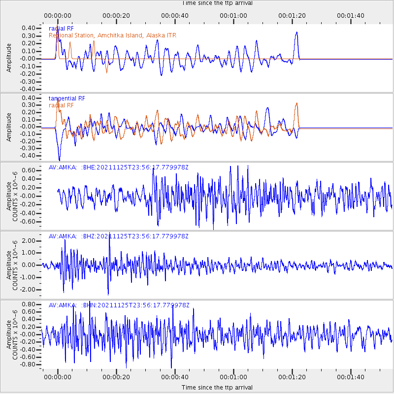
AMKA Regional Station, Amchitka Island, Alaska - Earthquake Result Viewer
*The percent match for this event was below the threshold and hence no stack was calculated.
| Earthquake location: |
Myanmar-India Border Region |
| Earthquake latitude/longitude: |
22.8/93.5 |
| Earthquake time(UTC): |
2021/11/25 (329) 23:45:41 GMT |
| Earthquake Depth: |
42 km |
| Earthquake Magnitude: |
5.8 mww |
| Earthquake Catalog/Contributor: |
NEIC PDE/us |
|
| Network: |
AV Alaska Volcano Observatory |
| Station: |
AMKA Regional Station, Amchitka Island, Alaska |
| Lat/Lon: |
51.38 N/179.30 E |
| Elevation: |
116 m |
|
| Distance: |
70.0 deg |
| Az: |
41.707 deg |
| Baz: |
281.594 deg |
| Ray Param: |
$rayparam |
*The percent match for this event was below the threshold and hence was not used in the summary stack. |
|
| Radial Match: |
59.225952 % |
| Radial Bump: |
400 |
| Transverse Match: |
56.26735 % |
| Transverse Bump: |
400 |
| SOD ConfigId: |
26694651 |
| Insert Time: |
2021-12-09 23:50:39.019 +0000 |
| GWidth: |
2.5 |
| Max Bumps: |
400 |
| Tol: |
0.001 |
|
Signal To Noise
| Channel | StoN | STA | LTA |
| AV:AMKA: :BHZ:20211125T23:56:17.779978Z | 5.3534784 | 8.387595E-7 | 1.5667561E-7 |
| AV:AMKA: :BHN:20211125T23:56:17.779978Z | 2.022895 | 2.3953515E-7 | 1.18412046E-7 |
| AV:AMKA: :BHE:20211125T23:56:17.779978Z | 2.0998926 | 3.1126856E-7 | 1.4823071E-7 |
| Arrivals |
| Ps | |
| PpPs | |
| PsPs/PpSs | |


