SIND YL.SIND - Earthquake Result Viewer
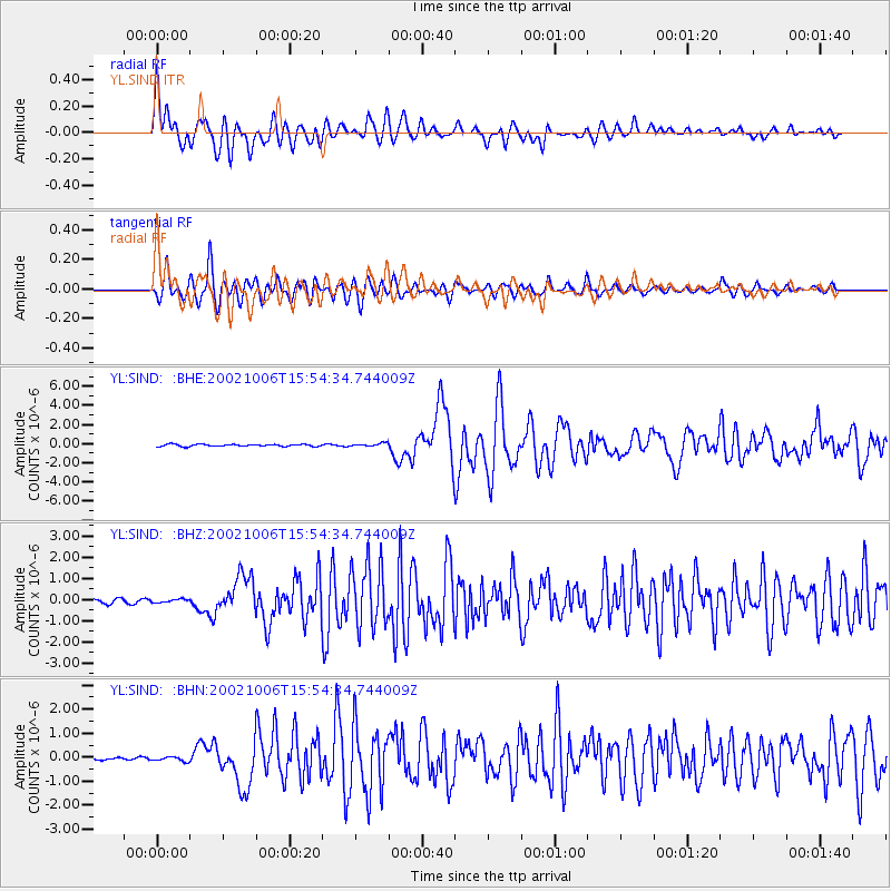
Earthquake location: Sumbawa Region, Indonesia
Earthquake latitude/longitude: -8.2/118.3
Earthquake time(UTC): 2002/10/06 (279) 15:46:33 GMT
Earthquake Depth: 10 km
Earthquake Magnitude: 5.8 MB, 6.0 MS, 6.2 MW, 6.2 MW
Earthquake Catalog/Contributor: WHDF/NEIC
Network: YL Himalayan Nepal Tibet Experiment
Station: SIND YL.SIND
Lat/Lon: 27.21 N/85.91 E
Elevation: 465 m
Distance: 47.2 deg
Az: 319.373 deg
Baz: 133.634 deg
Ray Param: 0.070160046
Estimated Moho Depth: 37.25 km
Estimated Crust Vp/Vs: 2.08
Assumed Crust Vp: 6.142 km/s
Estimated Crust Vs: 2.96 km/s
Estimated Crust Poisson's Ratio: 0.35
Radial Match: 84.954 %
Radial Bump: 400
Transverse Match: 81.591934 %
Transverse Bump: 400
SOD ConfigId: 16820
Insert Time: 2010-02-26 16:11:20.502 +0000
GWidth: 2.5
Max Bumps: 400
Tol: 0.001

Signal To Noise

ChannelStoNSTALTA
YL:SIND: :BHZ:20021006T15:54:34.744009Z1.03581667.980656E-87.7047005E-8
YL:SIND: :BHN:20021006T15:54:34.744009Z2.07993229.544829E-84.58901E-8
YL:SIND: :BHE:20021006T15:54:34.744009Z1.51885831.6330124E-71.0751578E-7
Arrivals
Ps6.8 SECOND
PpPs18 SECOND
PsPs/PpSs25 SECOND