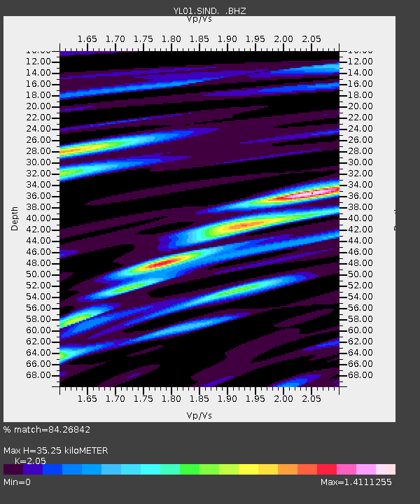
SIND YL.SIND - Earthquake Result Viewer

Earthquake location: Solomon Islands
Earthquake latitude/longitude: -10.9/161.2
Earthquake time(UTC): 2002/10/01 (274) 08:46:55 GMT
Earthquake Depth: 10 km
Earthquake Magnitude: 5.7 MB, 5.5 MS, 5.8 MW, 5.6 MW
Earthquake Catalog/Contributor: WHDF/NEIC
Network: YL Himalayan Nepal Tibet Experiment
Station: SIND YL.SIND
Lat/Lon: 27.21 N/85.91 E
Elevation: 465 m
Distance: 82.2 deg
Az: 299.597 deg
Baz: 106.492 deg
Ray Param: 0.047074568
Estimated Moho Depth: 35.25 km
Estimated Crust Vp/Vs: 2.05
Assumed Crust Vp: 6.142 km/s
Estimated Crust Vs: 2.996 km/s
Estimated Crust Poisson's Ratio: 0.34
Radial Match: 84.26842 %
Radial Bump: 400
Transverse Match: 86.25627 %
Transverse Bump: 400
SOD ConfigId: 16820
Insert Time: 2010-02-26 16:11:21.576 +0000
GWidth: 2.5
Max Bumps: 400
Tol: 0.001

Signal To Noise

ChannelStoNSTALTA
YL:SIND: :BHZ:20021001T08:58:45.333Z0.678092969.9110416E-81.4616052E-7
YL:SIND: :BHN:20021001T08:58:45.333Z1.33459121.5642364E-71.1720716E-7
YL:SIND: :BHE:20021001T08:58:45.333Z0.97068331.300278E-71.3395493E-7
Arrivals
Ps6.2 SECOND
PpPs17 SECOND
PsPs/PpSs23 SECOND