
SIND YL.SIND - Earthquake Result Viewer
| ||||||||||||||||||
| ||||||||||||||||||
| ||||||||||||||||||
|
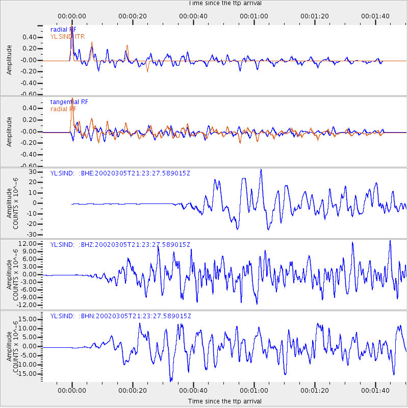
Signal To Noise
| Channel | StoN | STA | LTA |
| YL:SIND: :BHZ:20020305T21:23:27.589015Z | 1.2349994 | 1.3019464E-7 | 1.0542081E-7 |
| YL:SIND: :BHN:20020305T21:23:27.589015Z | 1.9162219 | 2.4655802E-7 | 1.2866883E-7 |
| YL:SIND: :BHE:20020305T21:23:27.589015Z | 2.9407365 | 3.5884034E-7 | 1.2202396E-7 |
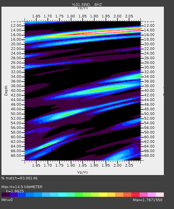
| Arrivals | |
| Ps | 2.4 SECOND |
| PpPs | 6.6 SECOND |
| PsPs/PpSs | 9.0 SECOND |

