SIND YL.SIND - Earthquake Result Viewer
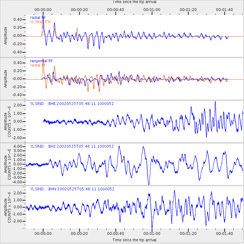
Earthquake location: South Of Alaska
Earthquake latitude/longitude: 53.8/-161.1
Earthquake time(UTC): 2002/05/25 (145) 05:36:31 GMT
Earthquake Depth: 33 km
Earthquake Magnitude: 5.5 MB, 6.1 MS, 6.5 MW, 6.4 MW
Earthquake Catalog/Contributor: WHDF/NEIC
Network: YL Himalayan Nepal Tibet Experiment
Station: SIND YL.SIND
Lat/Lon: 27.21 N/85.91 E
Elevation: 465 m
Distance: 80.8 deg
Az: 303.835 deg
Baz: 33.578 deg
Ray Param: 0.04799632
Estimated Moho Depth: 38.25 km
Estimated Crust Vp/Vs: 2.02
Assumed Crust Vp: 6.142 km/s
Estimated Crust Vs: 3.044 km/s
Estimated Crust Poisson's Ratio: 0.34
Radial Match: 87.29785 %
Radial Bump: 400
Transverse Match: 68.58701 %
Transverse Bump: 400
SOD ConfigId: 16844
Insert Time: 2010-02-26 16:11:38.569 +0000
GWidth: 2.5
Max Bumps: 400
Tol: 0.001

Signal To Noise

ChannelStoNSTALTA
YL:SIND: :BHZ:20020525T05:48:11.100005Z3.11710174.3366154E-71.3912333E-7
YL:SIND: :BHN:20020525T05:48:11.100005Z1.02649991.8591736E-71.8111776E-7
YL:SIND: :BHE:20020525T05:48:11.100005Z1.4936981.8621809E-71.2466916E-7
Arrivals
Ps6.5 SECOND
PpPs18 SECOND
PsPs/PpSs25 SECOND