SIND YL.SIND - Earthquake Result Viewer
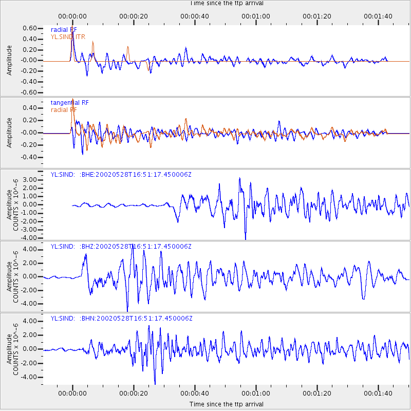
Earthquake location: Taiwan Region
Earthquake latitude/longitude: 24.1/122.3
Earthquake time(UTC): 2002/05/28 (148) 16:45:17 GMT
Earthquake Depth: 33 km
Earthquake Magnitude: 5.8 MB, 5.9 MS, 6.0 MW, 6.0 MW
Earthquake Catalog/Contributor: WHDF/NEIC
Network: YL Himalayan Nepal Tibet Experiment
Station: SIND YL.SIND
Lat/Lon: 27.21 N/85.91 E
Elevation: 465 m
Distance: 32.9 deg
Az: 283.308 deg
Baz: 87.216 deg
Ray Param: 0.078423776
Estimated Moho Depth: 29.0 km
Estimated Crust Vp/Vs: 1.60
Assumed Crust Vp: 6.142 km/s
Estimated Crust Vs: 3.833 km/s
Estimated Crust Poisson's Ratio: 0.18
Radial Match: 84.18614 %
Radial Bump: 400
Transverse Match: 83.85666 %
Transverse Bump: 400
SOD ConfigId: 16844
Insert Time: 2010-02-26 16:11:40.187 +0000
GWidth: 2.5
Max Bumps: 400
Tol: 0.001

Signal To Noise

ChannelStoNSTALTA
YL:SIND: :BHZ:20020528T16:51:17.450006Z12.0325111.3313346E-61.1064479E-7
YL:SIND: :BHN:20020528T16:51:17.450006Z1.4544281.5983089E-71.0989261E-7
YL:SIND: :BHE:20020528T16:51:17.450006Z5.88308057.4335E-71.2635387E-7
Arrivals
Ps3.1 SECOND
PpPs11 SECOND
PsPs/PpSs14 SECOND