You are here: Home > Network List > TX - Texas Seismological Network Stations List
> Station WTFS Witchita Falls > Earthquake Result Viewer
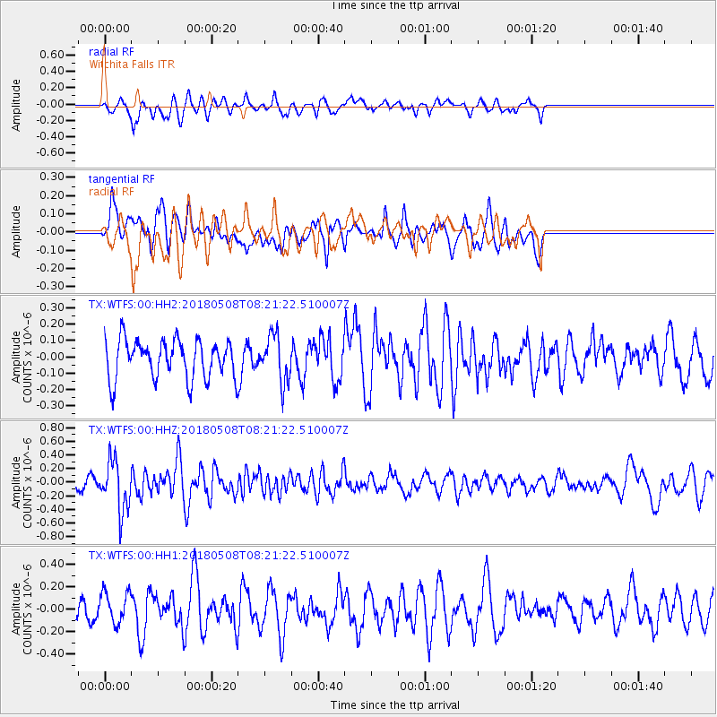
WTFS Witchita Falls - Earthquake Result Viewer
*The percent match for this event was below the threshold and hence no stack was calculated.
| Earthquake location: |
Gulf Of Alaska |
| Earthquake latitude/longitude: |
56.4/-148.5 |
| Earthquake time(UTC): |
2018/05/08 (128) 08:14:12 GMT |
| Earthquake Depth: |
10 km |
| Earthquake Magnitude: |
5.5 Mww |
| Earthquake Catalog/Contributor: |
NEIC PDE/us |
|
| Network: |
TX Texas Seismological Network |
| Station: |
WTFS Witchita Falls |
| Lat/Lon: |
33.77 N/98.46 W |
| Elevation: |
277 m |
|
| Distance: |
40.7 deg |
| Az: |
102.119 deg |
| Baz: |
319.215 deg |
| Ray Param: |
$rayparam |
*The percent match for this event was below the threshold and hence was not used in the summary stack. |
|
| Radial Match: |
57.531696 % |
| Radial Bump: |
369 |
| Transverse Match: |
43.424515 % |
| Transverse Bump: |
386 |
| SOD ConfigId: |
2665671 |
| Insert Time: |
2018-05-22 08:19:37.992 +0000 |
| GWidth: |
2.5 |
| Max Bumps: |
400 |
| Tol: |
0.001 |
|
Signal To Noise
| Channel | StoN | STA | LTA |
| TX:WTFS:00:HHZ:20180508T08:21:22.510007Z | 3.2912931 | 3.711795E-7 | 1.1277619E-7 |
| TX:WTFS:00:HH1:20180508T08:21:22.510007Z | 1.0584561 | 1.396435E-7 | 1.3193132E-7 |
| TX:WTFS:00:HH2:20180508T08:21:22.510007Z | 1.1992875 | 1.4147231E-7 | 1.1796363E-7 |
| Arrivals |
| Ps | |
| PpPs | |
| PsPs/PpSs | |


