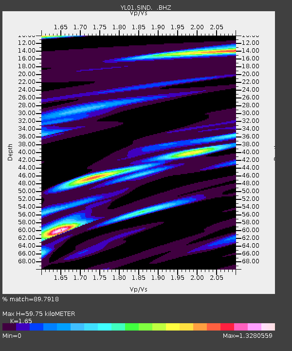
SIND YL.SIND - Earthquake Result Viewer

Earthquake location: Southeast Of Honshu, Japan
Earthquake latitude/longitude: 31.0/142.0
Earthquake time(UTC): 2002/08/20 (232) 10:59:32 GMT
Earthquake Depth: 9.0 km
Earthquake Magnitude: 5.4 MB, 6.2 MS, 6.3 MW, 6.1 MW
Earthquake Catalog/Contributor: WHDF/NEIC
Network: YL Himalayan Nepal Tibet Experiment
Station: SIND YL.SIND
Lat/Lon: 27.21 N/85.91 E
Elevation: 465 m
Distance: 48.7 deg
Az: 280.421 deg
Baz: 71.519 deg
Ray Param: 0.069193
Estimated Moho Depth: 59.75 km
Estimated Crust Vp/Vs: 1.65
Assumed Crust Vp: 6.142 km/s
Estimated Crust Vs: 3.722 km/s
Estimated Crust Poisson's Ratio: 0.21
Radial Match: 89.7918 %
Radial Bump: 400
Transverse Match: 71.63082 %
Transverse Bump: 400
SOD ConfigId: 16844
Insert Time: 2010-02-26 16:11:59.624 +0000
GWidth: 2.5
Max Bumps: 400
Tol: 0.001

Signal To Noise

ChannelStoNSTALTA
YL:SIND: :BHZ:20020820T11:07:45.595012Z5.6101078.8633E-71.5798807E-7
YL:SIND: :BHN:20020820T11:07:45.595012Z1.51849762.2114465E-71.4563385E-7
YL:SIND: :BHE:20020820T11:07:45.595012Z2.9831865.088091E-71.7055896E-7
Arrivals
Ps6.7 SECOND
PpPs24 SECOND
PsPs/PpSs31 SECOND