
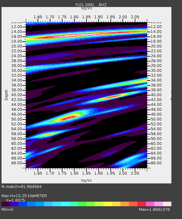
SIND YL.SIND - Earthquake Result Viewer
| ||||||||||||||||||
| ||||||||||||||||||
| ||||||||||||||||||
|
Signal To Noise
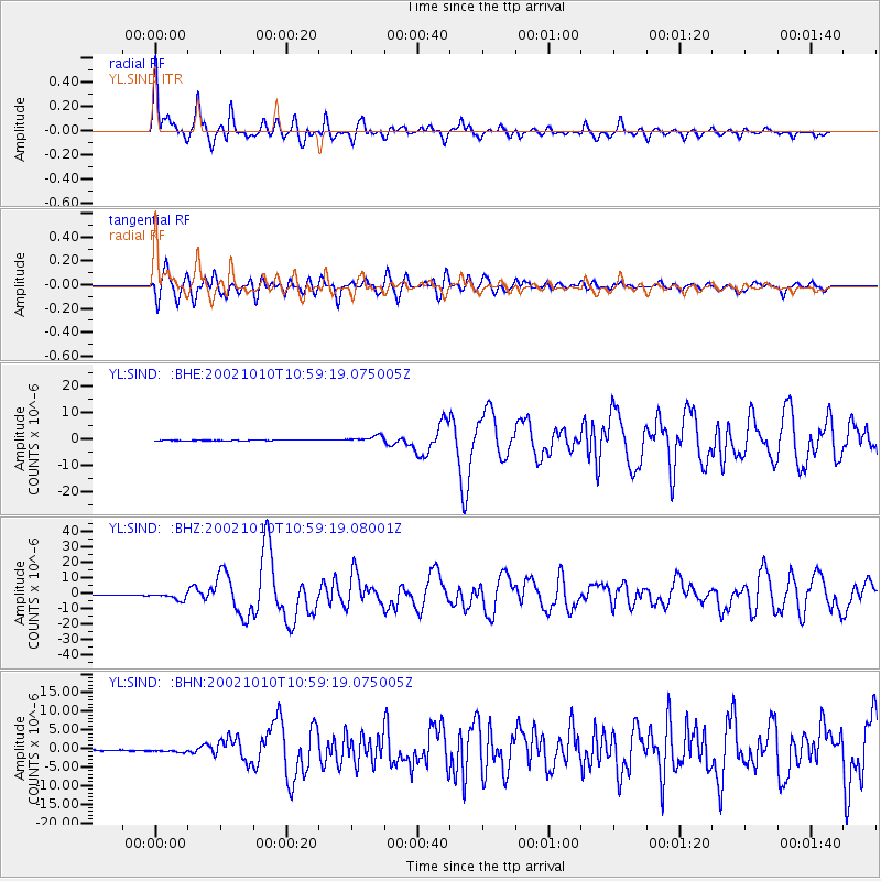
| Channel | StoN | STA | LTA |
| YL:SIND: :BHZ:20021010T10:59:19.08001Z | 15.940279 | 2.3758528E-6 | 1.4904712E-7 |
| YL:SIND: :BHN:20021010T10:59:19.075005Z | 4.1429453 | 4.0960802E-7 | 9.8868796E-8 |
| YL:SIND: :BHE:20021010T10:59:19.075005Z | 10.776943 | 1.1510672E-6 | 1.0680832E-7 |
| Arrivals | |
| Ps | 2.1 SECOND |
| PpPs | 6.7 SECOND |
| PsPs/PpSs | 8.8 SECOND |

