You are here: Home > Network List > CI - Caltech Regional Seismic Network Stations List
> Station MPP McPhearson Peak > Earthquake Result Viewer
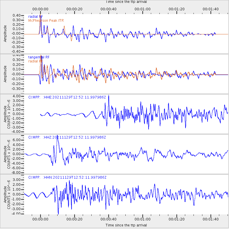
MPP McPhearson Peak - Earthquake Result Viewer
*The percent match for this event was below the threshold and hence no stack was calculated.
| Earthquake location: |
Southeast Of Honshu, Japan |
| Earthquake latitude/longitude: |
31.1/142.8 |
| Earthquake time(UTC): |
2021/11/29 (333) 12:40:43 GMT |
| Earthquake Depth: |
10 km |
| Earthquake Magnitude: |
6.6 Mi |
| Earthquake Catalog/Contributor: |
NEIC PDE/pt |
|
| Network: |
CI Caltech Regional Seismic Network |
| Station: |
MPP McPhearson Peak |
| Lat/Lon: |
34.89 N/119.81 W |
| Elevation: |
1739 m |
|
| Distance: |
78.3 deg |
| Az: |
56.346 deg |
| Baz: |
299.705 deg |
| Ray Param: |
$rayparam |
*The percent match for this event was below the threshold and hence was not used in the summary stack. |
|
| Radial Match: |
81.87785 % |
| Radial Bump: |
400 |
| Transverse Match: |
77.66702 % |
| Transverse Bump: |
400 |
| SOD ConfigId: |
26694651 |
| Insert Time: |
2021-12-13 12:50:01.340 +0000 |
| GWidth: |
2.5 |
| Max Bumps: |
400 |
| Tol: |
0.001 |
|
Signal To Noise
| Channel | StoN | STA | LTA |
| CI:MPP: :HHZ:20211129T12:52:11.997986Z | 1.8352888 | 2.8616037E-7 | 1.5592119E-7 |
| CI:MPP: :HHN:20211129T12:52:11.997986Z | 1.9612536 | 3.6077537E-7 | 1.8395141E-7 |
| CI:MPP: :HHE:20211129T12:52:11.997986Z | 3.3628511 | 6.2542057E-7 | 1.8597925E-7 |
| Arrivals |
| Ps | |
| PpPs | |
| PsPs/PpSs | |


