You are here: Home > Network List > US - United States National Seismic Network Stations List
> Station MNTX Cornudas Mountains, Texas, USA > Earthquake Result Viewer
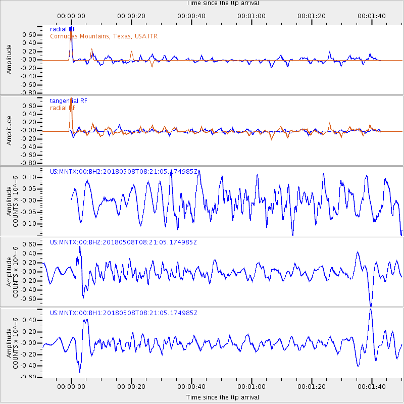
MNTX Cornudas Mountains, Texas, USA - Earthquake Result Viewer
*The percent match for this event was below the threshold and hence no stack was calculated.
| Earthquake location: |
Gulf Of Alaska |
| Earthquake latitude/longitude: |
56.4/-148.5 |
| Earthquake time(UTC): |
2018/05/08 (128) 08:14:12 GMT |
| Earthquake Depth: |
10 km |
| Earthquake Magnitude: |
5.5 Mww |
| Earthquake Catalog/Contributor: |
NEIC PDE/us |
|
| Network: |
US United States National Seismic Network |
| Station: |
MNTX Cornudas Mountains, Texas, USA |
| Lat/Lon: |
31.70 N/105.38 W |
| Elevation: |
404 m |
|
| Distance: |
38.7 deg |
| Az: |
111.239 deg |
| Baz: |
322.512 deg |
| Ray Param: |
$rayparam |
*The percent match for this event was below the threshold and hence was not used in the summary stack. |
|
| Radial Match: |
72.166336 % |
| Radial Bump: |
274 |
| Transverse Match: |
61.797474 % |
| Transverse Bump: |
400 |
| SOD ConfigId: |
2665671 |
| Insert Time: |
2018-05-22 08:20:37.488 +0000 |
| GWidth: |
2.5 |
| Max Bumps: |
400 |
| Tol: |
0.001 |
|
Signal To Noise
| Channel | StoN | STA | LTA |
| US:MNTX:00:BHZ:20180508T08:21:05.174985Z | 2.8177037 | 2.8855445E-7 | 1.0240767E-7 |
| US:MNTX:00:BH1:20180508T08:21:05.174985Z | 3.4037902 | 2.6572204E-7 | 7.806651E-8 |
| US:MNTX:00:BH2:20180508T08:21:05.174985Z | 1.5480183 | 7.003984E-8 | 4.524484E-8 |
| Arrivals |
| Ps | |
| PpPs | |
| PsPs/PpSs | |


