You are here: Home > Network List > CI - Caltech Regional Seismic Network Stations List
> Station BAR Barrett, Tecate, CA, USA > Earthquake Result Viewer
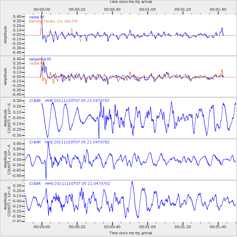
BAR Barrett, Tecate, CA, USA - Earthquake Result Viewer
*The percent match for this event was below the threshold and hence no stack was calculated.
| Earthquake location: |
Southeast Of Honshu, Japan |
| Earthquake latitude/longitude: |
31.2/142.5 |
| Earthquake time(UTC): |
2021/11/30 (334) 06:53:32 GMT |
| Earthquake Depth: |
7.9 km |
| Earthquake Magnitude: |
5.5 mww |
| Earthquake Catalog/Contributor: |
NEIC PDE/us |
|
| Network: |
CI Caltech Regional Seismic Network |
| Station: |
BAR Barrett, Tecate, CA, USA |
| Lat/Lon: |
32.68 N/116.67 W |
| Elevation: |
521 m |
|
| Distance: |
81.9 deg |
| Az: |
56.788 deg |
| Baz: |
301.805 deg |
| Ray Param: |
$rayparam |
*The percent match for this event was below the threshold and hence was not used in the summary stack. |
|
| Radial Match: |
78.0022 % |
| Radial Bump: |
400 |
| Transverse Match: |
76.03826 % |
| Transverse Bump: |
400 |
| SOD ConfigId: |
26694651 |
| Insert Time: |
2021-12-14 07:02:28.618 +0000 |
| GWidth: |
2.5 |
| Max Bumps: |
400 |
| Tol: |
0.001 |
|
Signal To Noise
| Channel | StoN | STA | LTA |
| CI:BAR: :HHZ:20211130T07:05:21.047976Z | 1.8199925 | 4.4670327E-7 | 2.4544235E-7 |
| CI:BAR: :HHN:20211130T07:05:21.047976Z | 0.94882303 | 1.2722371E-7 | 1.3408582E-7 |
| CI:BAR: :HHE:20211130T07:05:21.047976Z | 0.7217998 | 1.14481004E-7 | 1.5860493E-7 |
| Arrivals |
| Ps | |
| PpPs | |
| PsPs/PpSs | |


