You are here: Home > Network List > US - United States National Seismic Network Stations List
> Station SCIA State Center, Iowa, USA > Earthquake Result Viewer
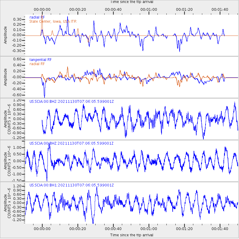
SCIA State Center, Iowa, USA - Earthquake Result Viewer
*The percent match for this event was below the threshold and hence no stack was calculated.
| Earthquake location: |
Southeast Of Honshu, Japan |
| Earthquake latitude/longitude: |
31.2/142.5 |
| Earthquake time(UTC): |
2021/11/30 (334) 06:53:32 GMT |
| Earthquake Depth: |
7.9 km |
| Earthquake Magnitude: |
5.5 mww |
| Earthquake Catalog/Contributor: |
NEIC PDE/us |
|
| Network: |
US United States National Seismic Network |
| Station: |
SCIA State Center, Iowa, USA |
| Lat/Lon: |
41.91 N/93.22 W |
| Elevation: |
312 m |
|
| Distance: |
91.0 deg |
| Az: |
38.074 deg |
| Baz: |
314.951 deg |
| Ray Param: |
$rayparam |
*The percent match for this event was below the threshold and hence was not used in the summary stack. |
|
| Radial Match: |
52.268063 % |
| Radial Bump: |
400 |
| Transverse Match: |
55.70167 % |
| Transverse Bump: |
400 |
| SOD ConfigId: |
26694651 |
| Insert Time: |
2021-12-14 07:17:36.240 +0000 |
| GWidth: |
2.5 |
| Max Bumps: |
400 |
| Tol: |
0.001 |
|
Signal To Noise
| Channel | StoN | STA | LTA |
| US:SCIA:00:BHZ:20211130T07:06:05.599001Z | 2.026917 | 7.7294254E-7 | 3.8133902E-7 |
| US:SCIA:00:BH1:20211130T07:06:05.599001Z | 1.2572602 | 5.107053E-7 | 4.0620498E-7 |
| US:SCIA:00:BH2:20211130T07:06:05.599001Z | 1.0793236 | 4.7442327E-7 | 4.3955606E-7 |
| Arrivals |
| Ps | |
| PpPs | |
| PsPs/PpSs | |


