You are here: Home > Network List > UU - University of Utah Regional Network Stations List
> Station CCUT Cedar City, UT, USA > Earthquake Result Viewer
CCUT Cedar City, UT, USA - Earthquake Result Viewer
*The percent match for this event was below the threshold and hence no stack was calculated.
| Earthquake location: |
Southeast Of Honshu, Japan |
| Earthquake latitude/longitude: |
31.2/142.5 |
| Earthquake time(UTC): |
2021/11/30 (334) 06:53:32 GMT |
| Earthquake Depth: |
7.9 km |
| Earthquake Magnitude: |
5.5 mww |
| Earthquake Catalog/Contributor: |
NEIC PDE/us |
|
| Network: |
UU University of Utah Regional Network |
| Station: |
CCUT Cedar City, UT, USA |
| Lat/Lon: |
37.55 N/113.36 W |
| Elevation: |
2127 m |
|
| Distance: |
81.6 deg |
| Az: |
51.174 deg |
| Baz: |
302.894 deg |
| Ray Param: |
$rayparam |
*The percent match for this event was below the threshold and hence was not used in the summary stack. |
|
| Radial Match: |
38.50655 % |
| Radial Bump: |
400 |
| Transverse Match: |
58.341934 % |
| Transverse Bump: |
400 |
| SOD ConfigId: |
26694651 |
| Insert Time: |
2021-12-14 07:17:45.367 +0000 |
| GWidth: |
2.5 |
| Max Bumps: |
400 |
| Tol: |
0.001 |
|
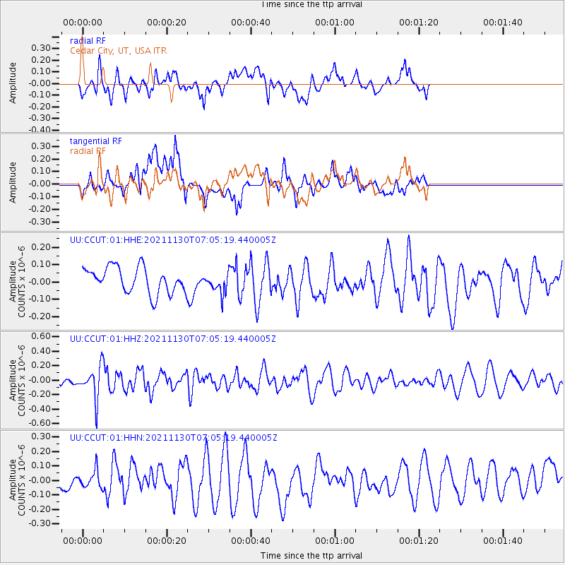
Signal To Noise
| Channel | StoN | STA | LTA |
| UU:CCUT:01:HHZ:20211130T07:05:19.440005Z | 1.9833066 | 2.2289933E-7 | 1.12387724E-7 |
| UU:CCUT:01:HHN:20211130T07:05:19.440005Z | 1.0539266 | 6.061226E-8 | 5.7510892E-8 |
| UU:CCUT:01:HHE:20211130T07:05:19.440005Z | 0.8157491 | 5.985168E-8 | 7.33702E-8 |
| Arrivals |
| Ps | |
| PpPs | |
| PsPs/PpSs | |


