You are here: Home > Network List > UW - Pacific Northwest Regional Seismic Network Stations List
> Station IRON Crane, OR, USA > Earthquake Result Viewer
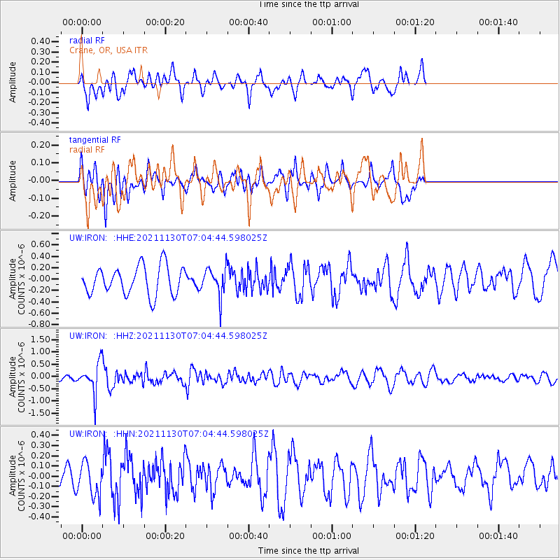
IRON Crane, OR, USA - Earthquake Result Viewer
*The percent match for this event was below the threshold and hence no stack was calculated.
| Earthquake location: |
Southeast Of Honshu, Japan |
| Earthquake latitude/longitude: |
31.2/142.5 |
| Earthquake time(UTC): |
2021/11/30 (334) 06:53:32 GMT |
| Earthquake Depth: |
7.9 km |
| Earthquake Magnitude: |
5.5 mww |
| Earthquake Catalog/Contributor: |
NEIC PDE/us |
|
| Network: |
UW Pacific Northwest Regional Seismic Network |
| Station: |
IRON Crane, OR, USA |
| Lat/Lon: |
43.36 N/118.47 W |
| Elevation: |
1226 m |
|
| Distance: |
75.2 deg |
| Az: |
48.147 deg |
| Baz: |
298.975 deg |
| Ray Param: |
$rayparam |
*The percent match for this event was below the threshold and hence was not used in the summary stack. |
|
| Radial Match: |
61.65715 % |
| Radial Bump: |
400 |
| Transverse Match: |
47.752064 % |
| Transverse Bump: |
356 |
| SOD ConfigId: |
26694651 |
| Insert Time: |
2021-12-14 07:18:35.597 +0000 |
| GWidth: |
2.5 |
| Max Bumps: |
400 |
| Tol: |
0.001 |
|
Signal To Noise
| Channel | StoN | STA | LTA |
| UW:IRON: :HHZ:20211130T07:04:44.598025Z | 3.736863 | 6.1645676E-7 | 1.6496638E-7 |
| UW:IRON: :HHN:20211130T07:04:44.598025Z | 1.1452875 | 1.7049068E-7 | 1.4886278E-7 |
| UW:IRON: :HHE:20211130T07:04:44.598025Z | 1.007627 | 2.5202962E-7 | 2.5012193E-7 |
| Arrivals |
| Ps | |
| PpPs | |
| PsPs/PpSs | |


