You are here: Home > Network List > CN - Canadian National Seismograph Network Stations List
> Station INK INUVIK, NT > Earthquake Result Viewer
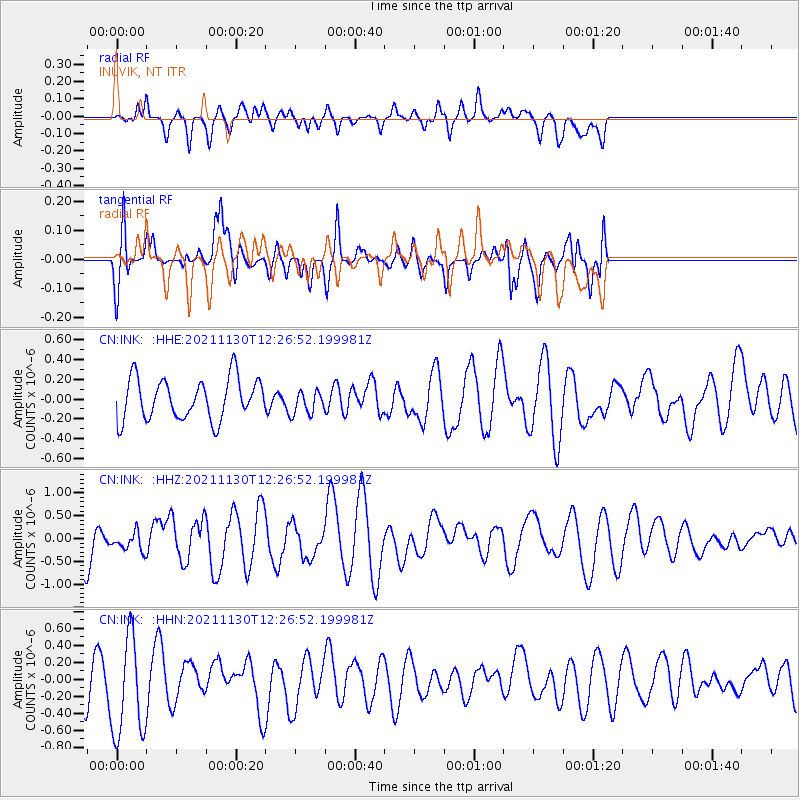
INK INUVIK, NT - Earthquake Result Viewer
*The percent match for this event was below the threshold and hence no stack was calculated.
| Earthquake location: |
New Ireland Region, P.N.G. |
| Earthquake latitude/longitude: |
-3.5/151.3 |
| Earthquake time(UTC): |
2021/11/30 (334) 12:14:34 GMT |
| Earthquake Depth: |
10 km |
| Earthquake Magnitude: |
5.7 Mww |
| Earthquake Catalog/Contributor: |
NEIC PDE/us |
|
| Network: |
CN Canadian National Seismograph Network |
| Station: |
INK INUVIK, NT |
| Lat/Lon: |
68.31 N/133.53 W |
| Elevation: |
44 m |
|
| Distance: |
87.8 deg |
| Az: |
21.076 deg |
| Baz: |
254.886 deg |
| Ray Param: |
$rayparam |
*The percent match for this event was below the threshold and hence was not used in the summary stack. |
|
| Radial Match: |
47.837498 % |
| Radial Bump: |
400 |
| Transverse Match: |
50.95365 % |
| Transverse Bump: |
400 |
| SOD ConfigId: |
26694651 |
| Insert Time: |
2021-12-14 12:21:38.816 +0000 |
| GWidth: |
2.5 |
| Max Bumps: |
400 |
| Tol: |
0.001 |
|
Signal To Noise
| Channel | StoN | STA | LTA |
| CN:INK: :HHZ:20211130T12:26:52.199981Z | 0.48188022 | 2.0542512E-7 | 4.2629912E-7 |
| CN:INK: :HHN:20211130T12:26:52.199981Z | 2.5090945 | 5.9777557E-7 | 2.3824353E-7 |
| CN:INK: :HHE:20211130T12:26:52.199981Z | 0.5851324 | 1.2186003E-7 | 2.0826057E-7 |
| Arrivals |
| Ps | |
| PpPs | |
| PsPs/PpSs | |


